Chimay hydroelectric power station
| Chimay hydroelectric power station | |||
|---|---|---|---|
| location | |||
|
|
|||
| Coordinates | 11 ° 18 ′ 25 ″ S , 75 ° 18 ′ 20 ″ W | ||
| country |
|
||
| place | Junín region | ||
| Waters | Río Tulumayo | ||
| Data | |||
| Type | Storage power plant | ||
| power | 150.9 MW | ||
| operator | Chinango | ||
| Start of operations | 2000 | ||
| turbine | 2 Francis turbines | ||
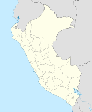
The Chimay hydropower plant (Spanish: Central Hidroeléctrica Chimay ) is located on the Tulumayo River in central Peru . The power plant is located in the Monobamba district in the Jauja province of the Junín administrative region . The plant is operated by Chinango.
The hydropower plant, which went into operation in 2000, is located on the left bank of the Río Tulumayo . It is located in the Peruvian Central Cordillera 21 km south of the city of San Ramón .
The Chimay dam ( ⊙ ) is located on the upper reaches of the Río Tulumayo. The 26.5 m high and 160 m wide dam dams the Río Tulumayo and its tributary Río Tambillo over a length of about 1.3 km. The reservoir has an area of up to 26 ha and a storage volume of 1.5 million m³.
Below the dam, the water is fed to the power plant via a 9170 m long pipe. The inlet level is at an altitude of 1321 m . The power plant has 2 Francis turbines (diameter 3.8 m) with a total output of 150.9 MW. The fall height is 192 m. The expansion water volume is 82 m³ / s. The substation is located directly next to the power station building. The water returns to the river below the power station. About 400 m downstream is the Monobamba II hydropower plant , which uses the slope of the Monobamba River .
![]() Map with all coordinates: OSM | WikiMap
Map with all coordinates: OSM | WikiMap
Web links
- Central Hidroeléctrica Chimay (November 20, 2015) at infraestructuraperuana.blogspot.com
