Doberburg watermill
| Doberburg watermill | ||
|---|---|---|
| The wing of the building with the engine room; the right outlet is the freewheel | ||
| location | ||
|
|
||
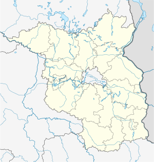
| Coordinates | 52 ° 0 '12 " N , 14 ° 14' 46" E | |
| country |
Germany Brandenburg |
|
| place | Love rose | |
| Waters | Doberburger Mühlenfließ | |
| power plant | ||
| Start of operation | 1993 (after reactivation) | |
| technology | ||
| Bottleneck performance | 0.011 megawatts | |
| Others | ||
The Doberburg watermill is an old watermill in Doberburg (a district of Lieberose in Brandenburg ) that is used today to generate electricity.
history

Doberburg, formerly Dobberbuss, belonged to the Lieberose rule from the Middle Ages until the 19th century, and from the 17th century onwards it was called Lieberose rule . In 1519 the rule was acquired by the vd Schulenburg family. In the deed of sale, Dobberbusch and the pier there was also mentioned as part of the rule . It could only have been the watermill in the village. In Schmettauschen map series an iron hammer is listed at the village. Part of the Lieberose reign was an after-fief of the v. Sternberg. During the inspection of the Sternberg fiefs by the Sternberg official Chr. W. Reinisch in 1774, it is mentioned that there used to be a "useful iron hammer" in the village, which was "almost completely" lost to the owner at the time, Hans Georg vd Schulenburg. Presumably the iron hammer was operated again as a water mill a little later, because the hammer mill is recorded in the original measuring table from 1846. In the topographical-statistical manual of the government district of Frankfurt a. O. from 1867 Dobberbuss is described as a village with a water mill near the village. The Bahroldmühle is mentioned separately.
The mill was used to grind grain until around 1912 and then, on a small scale, to generate electricity. It was originally driven by an undershot mill wheel . By 1960, the mill had the benefit of the larger state-owned mills are shut down. After the fall of the Berlin Wall , the Mechler family reactivated the mill to generate electricity in 1993.
business
The water power of the Doberburg mill flow is transmitted via a gear wheel that runs at up to 64 revolutions per minute, another gear wheel and a drive belt to the power generator, which at a water flow of around 1000 l / s (= 1 m 3 / s) the provides full power of 11 kilowatts. The electrical energy is then fed into the local network. If the flow carries more water, the flow rate must be reduced by opening the freewheel. If there is less water in the flow, this can only be compensated for for a very short period of time by accumulating water in front of the mill , since the right to accumulate only up to the 70 centimeter mark, so that accordingly less energy can be generated afterwards.
Lock channel
Since the river including the freewheel runs below the mill building and is therefore not navigable, a sluice canal was built for the peat barges to bypass the mill at the time of the peat cutting trade. The lock canal is now partially piped up, has little water left and is no longer navigable itself.
Individual evidence
- ↑ Götz Freiherr von Houwald : The Niederlausitzer manors and their owners. Volume III: District of Lübben. Verlag Degener & Co., owner Gerhard Gessner, Neustadt an der Aisch 1984, ISBN 3-7686-4109-0 , p. 164.
- ^ Prussian map picture 1: 25,000 first picture sheet 3951 Trebatsch. Published by the state surveying and geographic base information Brandenburg 2007. The original of this 1846 by v. Kowalewski colored map is in the possession of the Berlin State Library.
- ↑ Statistical Bureau of the Royal Government of Frankfurt a. O .: Topographical-statistical manual of the government district of Frankfurt a. O. 346 S., Frankfurt a. O., publishing house by Gustav Harnecker u. Co., 1867
Web links
- Watermill Doberburg on the website of the German Society for Milling and Mill Maintenance


