Watenstedt (Gevensleben)
|
Watenstedt
community Gevensleben
Coordinates: 52 ° 5 ′ 14 " N , 10 ° 50 ′ 6" E
|
||
|---|---|---|
| Height : | 96 m | |
| Incorporation : | March 1, 1974 | |
| Postal code : | 38384 | |
| Area code : | 05354 | |
|
Location of Watenstedt in Lower Saxony |
||
|
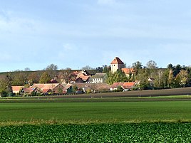
View of Watenstedt
|
||
Watenstedt is a district of the Lower Saxony community of Gevensleben in the Helmstedt district .
geography
The place is predominantly agricultural.
history
An excavation carried out in 2015 led to the dating of the district moat of Watenstedt to the beginning of the 5th millennium BC. The facility with a diameter of more than 50 meters is located on a hilltop near the village. The Hünenburg near Watenstedt can be attributed to a more recent era, which proves that the region was once again settled by farmers during the Bronze Age .
The village was first mentioned in a document in the 11th century, in 1147 Luthard I had bailiff rights to a church there, a chapel is documented for 1153. Luthard gave a hoof to the St. Lorenz monastery in Schöningen.
On March 1, 1974, Watenstedt was incorporated into the neighboring community of Gevensleben. In 1975 the Watenstedt sugar factory was closed.
Culture and sights
museum
In a former half-timbered farm house from 1850, the Heeseberg Museum, which opened on November 24, 1981, houses an important collection of various agricultural and household appliances as well as historical documents.
St. Stephen Church
The Romanesque church of St. Stephan was an important archdeacon seat in the early and high Middle Ages , i.e. an ecclesiastical administrative unit that was located directly below the diocese , in this case the Halberstadt diocese . The church has been Evangelical Lutheran since the Reformation and belongs to the regional church of Braunschweig . In the apse there are still Romanesque paintings that were uncovered and supplemented at the end of the 19th century.
Fortification
To the east of the village is the prehistoric and early medieval Hünenburg near Watenstedt , from which the ring-shaped ramparts still clearly rise today. The archaeological investigations carried out since 1998 allow the conclusion that the Hünenburg is the Hoohseoburg , which was a Saxon ( East Westphalian ) princely seat until the 8th century , but was then conquered by the Franks .
Web links
Individual evidence
- ↑ Georg Albert von Wülwerstedt: Hierographia Halberstadensis , in: Zeitschrift des Harz-Verein für Geschichte und Altertumskunde 5 (1872), here: p. 33.
- ↑ Peter Przybilla, Uwe Ohainski, Gerhard Streich: The noble lords of Meinersen. Genealogy, rule and property from the 12th to the 14th century , Hahnsche, Hannover 2007, p. 23.
- ^ Federal Statistical Office (ed.): Historical municipality directory for the Federal Republic of Germany. Name, border and key number changes in municipalities, counties and administrative districts from May 27, 1970 to December 31, 1982 . W. Kohlhammer GmbH, Stuttgart and Mainz 1983, ISBN 3-17-003263-1 , p. 272 .
- ^ History 1970 to 1979 on the website of the district of Helmstedt , accessed on February 25, 2018
- ^ Dirk Fochler: Cycling in Helmstedt. In: Helmstedter Nachrichten. Edition of May 4, 2019 (Sunday supplement).
- ^ History 1980 to 1989 on the website of the district of Helmstedt , accessed on February 25, 2018
- ^ Wolfgang Meibeyer: The beginnings of the settlements, in: Die Braunschweigische Landesgeschichte, Braunschweig 2000, p. 284.
- ↑ References to romanik.de
- ^ Wolfgang Meibeyer: The beginnings of the settlements , in: Die Braunschweigische Landesgeschichte, Braunschweig 2000, pp. 267-300, here: p. 284.


