Waterford, Connecticut
| Waterford | ||
|---|---|---|
|
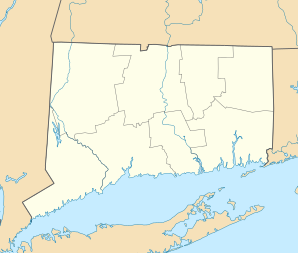
Location in Connecticut
|
||
| Basic data | ||
| Foundation : | 1801 | |
| State : | United States | |
| State : | Connecticut | |
| County : | New London County | |
| Coordinates : | 41 ° 21 ′ N , 72 ° 9 ′ W | |
| Time zone : | Eastern ( UTC − 5 / −4 ) | |
| Residents : | 18,940 (as of 2005) | |
| Population density : | 222.8 inhabitants per km 2 | |
| Area : | 115.0 km 2 (approx. 44 mi 2 ) of which 85.0 km 2 (approx. 33 mi 2 ) are land |
|
| Height : | 14 m | |
| Postcodes : | 06375, 06385 | |
| Area code : | +1 860 | |
| FIPS : | 09-80280 | |
| GNIS ID : | 0213526 | |
| Website : | www.waterfordct.org | |
Waterford is a city in New London County in the US state Connecticut , United States , with 18,800 inhabitants (as of 2004). The geographic coordinates are 41.34 ° north, 72.14 ° west. The urban area has a size of 115.0 km². In the urban area is the Millstone nuclear power plant , which has three reactors .
sons and daughters of the town
- Jesse Metcalfe (born 1978), actor
Web links
Commons : Waterford (Connecticut) - Collection of images, videos, and audio files
- Official website of the City of Waterford
