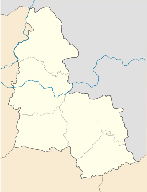
Verkhnya Syrowatka
| Verkhnya Syrowatka | ||
| Верхня Сироватка | ||

|
|
|
| Basic data | ||
|---|---|---|
| Oblast : | Sumy Oblast | |
| Rajon : | Sumy Raion | |
| Height : | 139 m | |
| Area : | Information is missing | |
| Residents : | 3,814 (2004) | |
| Postcodes : | 42351 | |
| Area code : | +380 542 | |
| Geographic location : | 50 ° 50 ' N , 34 ° 57' E | |
| KOATUU : | 5924782901 | |
| Administrative structure : | 4 villages 1 settlement | |
| Address: | пл. Гагаріна 2 42351 с. Верхня Сироватка |
|
| Statistical information | ||
|
|
||
Verkhnya Syrowatka ( Ukrainian Верхня Сироватка ; Russian Верхняя Сыроватка Verkhnyaya Syrowatka ) is a village in the Ukrainian Sumy Oblast with about 3800 inhabitants (2004).
The village, first mentioned in writing in 1653, lies on the bank of the Syrowatka ( Сироватка ), a 58 km long tributary of the Psel . The N 12 trunk road and the P-45 regional road run through the village . Sumy Rajon and Oblast Center is 15 kilometers northwest of the village.
The village is the administrative center of the district council of the same name in Sumy Raion , which includes the villages Novoselyzja ( Новоселиця ⊙ ) with about 430 inhabitants, Salisnjak ( Залізняк ⊙ ) with about 380 inhabitants, Stinka ( Стінка ⊙ ) with about 110 inhabitants Sachariwske ( Новоселиця ⊙ ) is one having about 10 residents.
Individual evidence
- ^ Website of the village on the Verkhovna Rada website , accessed on August 10, 2017 (Ukrainian)

