Werribee
| Werribee | |||||||||
|---|---|---|---|---|---|---|---|---|---|
 Werribee Park |
|||||||||
|
|||||||||
|
|||||||||
|
|||||||||
|
|||||||||
|
|
|||||||||
Werribee is a district of the metropolis Melbourne in the state of Victoria , Australia . It is located 20 miles southwest of downtown on the Princes Highway in the City of Wyndham Administrative Area (LGA) . At the last census in 2016, Werribee had 40,345 residents. The Werribee River of the same name flows through the city .
history
The name Werribee means something like backbone in the language of the Aborigines . It is believed that this name is due to the characteristic shape of the course of the river. The Werribee River also represented a natural boundary between two tribal areas, that of the Woiwurong in the northeast and that of the Wathaurong in the southwest, although other groups have also visited the area. One of them was the Yawangi tribe, whose last survivor "King" Bill Leigh died in 1912 in Wooloomanata Station.
The first European farmers settled here under the leadership of John Batman and his Port Phillip Association. The first settlement emerged in the early 1850s. The place was called Wyndham, now the name of the local administrative area, in honor of the Scottish soldier Sir Henry Wyndham . The first post office opened on January 12, 1858. The city received its current name in 1909.
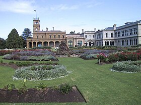
One of the most famous personalities at this time was Thomas Chirnside, attracted by the wide plain, which is particularly suitable for agriculture, he settled here at the end of the 1840s and, together with his brother Andrew, owned more than 280 km² of land in the 1863 Area. In the mid-1870s, he built one of Victoria's finest colonial houses, now known as Werribee Park Manison . By the middle of the 1880s, the two brothers were able to expand their property to over 400 km².
The city was growing steadily at this time, which was also thanks to the newly laid railway line from Melbourne to Geelong in 1857 .
Many military installations were installed in and around Werribee during the First and Second World Wars : the Royal Australian Air Force base at Point Cook with two airports at Laverton and Avalon; Ammunition depots and temporary runways. During the second half of the 20th century, the military personnel contributed significantly to the cultural and economic development of the city. In 1971 Werribee had a population of 12,000.
With a better connection to the center of Melbourne, initially with the West Gate Bridge over the Yarra River in 1978 and with the connection to the railway network in 1985, the attractiveness continued to grow.
sons and daughters of the town
- Thomas Francis Little (1925–2008), Archbishop of Melbourne
- Danny Tiatto (born 1973), Australian soccer player
Web links
- Open Learning Australian Places - Werribee ( Memento from June 20, 2005 in the Internet Archive )
Individual evidence
- ↑ a b Australian Bureau of Statistics : Werribee ( English ) In: 2016 Census QuickStats . June 27, 2017. Retrieved April 27, 2020.
- ^ Premier Postal History: Post Office List . Retrieved October 9, 2011.
- ↑ a b Werribee - A brief history , www.intown.com.au. Retrieved October 8, 2011. (English)
