White Plains (Georgia)
| White Plains | ||
|---|---|---|
|
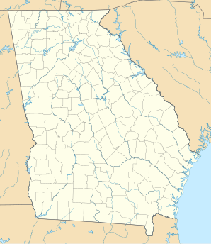
Location in Georgia
|
||
| Basic data | ||
| State : | United States | |
| State : | Georgia | |
| County : | Greene County | |
| Coordinates : | 33 ° 29 ′ N , 83 ° 2 ′ W | |
| Time zone : | Eastern ( UTC − 5 / −4 ) | |
| Residents : | 283 (as of: 2000) | |
| Population density : | 23.8 inhabitants per km 2 | |
| Area : | 11.9 km 2 (approx. 5 mi 2 ) of which 11.9 km 2 (approx. 5 mi 2 ) is land |
|
| Height : | 211 m | |
| Postal code : | 30678 | |
| Area code : | +1 706 | |
| FIPS : | 13-82692 | |
| GNIS ID : | 0356635 | |
White Plains is a place in Greene County in the US state of Georgia in the United States . According to an official estimate in 2006, the village had a population of 305 inhabitants. The community area is 11.9 km².
geography
White Plains is located away from major traffic routes a little east of Lake Oconee . The next larger towns are Greensboro (approx. 15 km northwest) and Milledgeville (approx. 30 km south).
population
White Plains residents are 55.8% white and 44.2% African-American. The per capita income is $ 12,328, 24.6% of the population lives below the poverty line.
Attractions
The place has three churches: the White Plains Baptist Church, the White Plains Methodist Church and the Second Baptist Church.
