Wiesensee (Tyrol)
| Wiesensee | ||
|---|---|---|

|
||
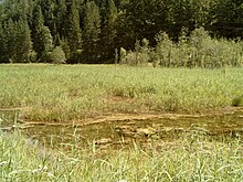
| Northwest bank, looking south | ||
| Geographical location | Tyrol , Austria | |
| Tributaries | Katzelbach | |
| Drain | Katzelbach → Loferbach (Griesl-, Hasel-, Strubbach) → Saalach | |
| Location close to the shore | Hochfilzen | |
| Data | ||
| Coordinates | 47 ° 29 ′ 47 " N , 12 ° 36 ′ 30" E | |
|
|
||
| Altitude above sea level | 927 m above sea level A. | |
The Wiesensee is a small mountain lake between Pillersee and Hochfilzen at the southwestern foot of the Loferer Steinberge in the very east of the state of Tyrol .
The inflow and outflow is the Katzelbach towards Pillersee. There are no villages directly on the lake. The small town of Unterwarming is located south of the lake . On the west bank of the lake there is a narrow road with low car traffic , which is used by numerous hikers and cyclists as a connecting route without steep inclines between St. Ulrich am Pillersee and Hochfilzen.
The Wiesensee is increasingly silting up from the inflow. In the area of the inlet on the south bank of the lake there is an extensive reed bed zone , which merges into the open water surface in the north and gradually develops into a silting bog from the south .

