Hochfilzen
|
Hochfilzen
|
||
|---|---|---|
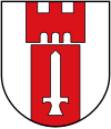
| coat of arms | Austria map | |
|
|
||
| Basic data | ||
| Country: | Austria | |
| State : | Tyrol | |
| Political District : | Kitzbühel | |
| License plate : | KB | |
| Surface: | 32.66 km² | |
| Coordinates : | 47 ° 28 ' N , 12 ° 37' E | |
| Height : | 959 m above sea level A. | |
| Residents : | 1,243 (January 1, 2020) | |
| Population density : | 38 inhabitants per km² | |
| Postal code : | 6395 | |
| Area code : | 05359 | |
| Community code : | 7 04 05 | |
| NUTS region | AT335 | |
| UN / LOCODE | AT HOC | |
| Address of the municipal administration: |
Dorf 35 6395 Hochfilzen |
|
| Website: | ||
| politics | ||
| Mayor : | Konrad Walk (list of citizens) | |
|
Municipal Council : (2016) (13 members) |
||
| Location of Hochfilzen in the Kitzbühel district | ||
 Hochfilzen, tower of the Catholic parish church of Our Lady Maria Schnee |
||
| Source: Municipal data from Statistics Austria | ||
Hochfilzen is a municipality in the Kitzbühel district in Tyrol in Austria with 1243 inhabitants (as of January 1, 2020). The community is located in the judicial district of Kitzbühel .
geography
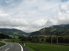
Hochfilzen is one of the five Pillerseetal communities and is located on the Grießenpass on the border with the state of Salzburg .
Neighboring communities
history
Hochfilzen was once a scattered settlement of farmhouses within the former Hofmark Pillersee . Hochfilzen is mentioned in a document for the first time in a list of goods from the Rott monastery from 1377. When the region was taken over by Tyrol in 1504, the rights of the monastery as Hofmark were retained.
The small rural village appeared at the Kitzbühel regional court as early as 1762 . The first school was built in 1753, but it was not successful. About 30 years later a school could be set up again. The lesson was held in the village inn. Finally, in 1813, the first school building was built . In 1906 a new building took place . During the administrative reform of 1833, the small Hochfilzen district developed into a community .
In 1875 the Salzburg-Tyrolean Railway was built , and thus Hochfilzen was connected to the most modern means of transport at that time .
In 1878 an artillery firing range was set up for the first time in the Schüttach-Au by the Austro-Hungarian Army , but it was closed again in 1908. It was reopened in 1939 and taken over by the armed forces after the Second World War .
With the establishment of the magnesite works in 1957, an economic boom took place in Hochfilzen. The company, which currently belongs to RHI Magnesita , continues to mine magnesite and manufacture refractory masses as an end product.
Population development

politics
The last mayoral elections took place at the same time as the municipal council elections on February 28, 2016. Konrad Walk, who took over from Sebastian Eder on April 19, was confirmed in office with a two-thirds majority.
The municipal council has 13 members. Six of them are on the citizens' list, two on the SPÖ , two on the Aufwind list , two on the Alternative für Hochfilzen-ah! , as well as one on the Hochfilzen Aktiv list .
The community board consists of Mayor Konrad Walk, Vice Mayor Michaela Wallner and Johann Eder from the Aufwind list , Helmuth Perterer from the Alternative für Hochfilzen list and Georg Arnold from the SPÖ.
Attractions
- Parish church built in 1745/46 with a baroque high altar statue of Maria Loreto from the previous chapel built in 1682 and a rococo crib with clothed figures; the church was expanded in 1960/61
economy
- Magnesite mining in the open pit method at Weißenstein (municipality of Fieberbrunn ) at an altitude between 1430 and 1700 meters and processing of magnesite have characterized the economic structure of the municipality since the mid-1950s.
- RHI Magnesita, world market leader for refractory products , has been operating a plant for the production of refractory products based on magnesite ( sintered magnesia ) in Hochfilzen since 1959 . This work also includes a 105 meter high chimney. A combination of bag filter and wet filter system reduces pollutant and dirt emissions.
tourism
In terms of tourism, the location between promoting Leogang mountains , Lofer Mountains and the Kitzbühel Alps the summer tourism and mainly because of the snow that falls to winter tourism with a focus on the Nordic skiing. The cross-country and biathlon center is known as the venue for cross-country and biathlon world cups and was the venue for the biathlon world championships in 1978 , 1998 , 2005 and 2017 .
Two tow lifts take skiers to the Buchensteinwand ski area , which connects Hochfilzen with Ortisei in the Pillerseetal.
traffic
- Street: Hochfilzen is located on the Hochkönigstrasse and the Salzburg-Tiroler Bahn.
- Train: His station is served by the S-Bahn Tirol and regional express trains.
Military training area
In 1875, Hochfilzen was connected to the railway network, and soon afterwards a military training area was built. The military training area is used today by the Austrian Armed Forces as an army sports center for biathlon and for the survival training courses of the hunting command . The military training area was one of the scenes in the Lucona scandal that rocked political Austria in the late 1970s.
Personalities
- Romed Baumann (* 1986), Austrian ski racer , grew up in Hochfilzen
- Dominik Landertinger (* 1988), former Austrian biathlete.
Web links
- Shooting times at the Hochfilzen military training area (Leogang municipal office)
- Community website
- Hochfilzen , in the history database ofthe association "fontes historiae - sources of history"
Individual evidence
- 70405 - Hochfilzen. Community data, Statistics Austria .
- ↑ Local council election 2016. Hochfilzen community, accessed on May 1, 2017 .
- ↑ Parish council. Hochfilzen municipality, accessed on May 1, 2017 .
- ↑ Hochfilzen gets World Cup 2017 ( memento from September 12, 2016 in the Internet Archive ); accessed on February 18, 2016
- ↑ Landertinger announces resignation. Retrieved April 20, 2020 .


