
Kirchberg in Tyrol
|
Kirchberg in Tyrol
|
||
|---|---|---|
| coat of arms | Austria map | |
 |
|
|
| Basic data | ||
| Country: | Austria | |
| State : | Tyrol | |
| Political District : | Kitzbühel | |
| License plate : | KB | |
| Surface: | 97.73 km² | |
| Coordinates : | 47 ° 27 ' N , 12 ° 19' E | |
| Height : | 837 m above sea level A. | |
| Residents : | 5,230 (January 1, 2020) | |
| Postal code : | 6365 | |
| Area code : | 05357 | |
| Community code : | 7 04 09 | |
| NUTS region | AT335 | |
| Address of the municipal administration: |
Hauptstrasse 8 6365 Kirchberg in Tirol |
|
| Website: | ||
| politics | ||
| Mayor : | Helmut Berger (SPÖ) | |
|
Municipal Council : (2010) (17 members) |
||
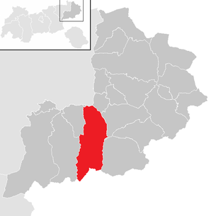
| Location of Kirchberg in Tirol in the Kitzbühel district | ||
  |
||
 Kirchberg |
||
| Source: Municipal data from Statistics Austria | ||

Kirchberg in Tirol is a municipality with 5230 inhabitants (as of January 1, 2020) in the Brixental , in the middle of the Kitzbühel Alps ( Tyrol , Austria ). The place is 837 m above sea level. A. The community is located in the judicial district of Kitzbühel .
geography
The community is located at the confluence of the Spertental and the Brixental, near Kitzbühel and Brixen im Thale.
The place is located directly on the valley watershed ( 828 m above sea level ) between the Leukental in the east and the Brixental in the west.
Districts of the municipality
The settlement consists of the main town of scattered hamlets and farms.
The districts of Kirchberg are:
|
|
|
Neighboring communities
The neighboring communities are:
|
history


The oldest traces of the settlement of Kirchberg go back to prehistoric times, namely to the younger Bronze Age (1100–900 BC). The first residents of Kirchberg were Illyrians . Around the middle of the 6th century, the Bavarians began to take over the land .
In 902 the royal official Rodolt gave the “Prihsnatala” to the Regensburg bishopric , who had the Brixental administered by bailiffs. In 1241 Sperten was first mentioned as the name of the village under the Chirchberg . 1333 is spoken of the "community and common all parishioners of Sperten".
In 1377 Bishop Konrad von Regensburg pledged the Brixental with Kirchberg to Bishop Friedrich von Chiemsee . In 1380 he sold it against payment of 18,000 Hungarian guilders with the reservation of repurchase and in 1385 against a payment of a further 8,000 Hungarian guilders forever to the Archbishop of Salzburg .
In 1816 the Brixental and with it Kirchberg became part of Tyrol.
Population development

Culture and sights
Events
- International Winterschool on Electronic Properties of Novel Materials, 4. – 11. March 2017
- Cordial Cup (youth football tournament), annually in May
- Brixentaler Admission Ride , annually in June
- KitzAlpBike Festival , annually in June
- Kirchberg village festival, annually in July (last Saturday in July)
- Kirchberg Flower Parade , annually on August 15th
- International classic car meeting , annually in August
- Tirol Ballon Cup (TBC), annually in September
- Almabtrieb and Almfest, annually in September
- Horse races on the harness racing track at Stöcklfeld (various)
- The traditional inauguration takes place here on Corpus Christi .
Economy and Infrastructure
Two-season tourism is particularly important from an economic point of view. The lifts in Kirchberg belong to the Kitzbühel cable car .
traffic
| Kirchberg valley pass ( valley watershed ) |
||
|---|---|---|
| Compass direction | east | west |
| height | 828 m above sea level A. | |
| region | Tyrol , Austria | |
| Watershed | Aschauer (Reither) Ache / Großache (Kössener Ache) / Tiroler Achen / Alz / Inn | Schleicherbach / Brixenbach / Brixentaler Ache / Inn |
| Valley locations | Kitzbühel | Worgl |
| expansion | Brixentalstrasse (B 170) | |
| Mountains | Hohe Salve / Kelchsauer Alps (both Kitzbühel Alps ) | |
| particularities | Valley watershed | |
| profile | ||
| Ø pitch | 1.3% (91 m / 7.2 km) | 1.5% (318 m / 21.5 km) |
| Coordinates | 47 ° 27 '4 " N , 12 ° 17' 57" E | |
Kirchberg in Tirol is located on Brixentalstrasse B 170 from Wörgl to Kitzbühel . In 1997/98 a bypass road with two tunnels was built, in 2001 the village center was connected to the bypass by a roundabout. There has been a parking garage with four underground floors since the 1980s.
Kirchberg can be reached via a train station of the Salzburg-Tiroler-Bahn .
politics
The last mayoral elections took place at the same time as the municipal council elections on February 28, 2016. Helmut Berger was confirmed as mayor with 68.25% of the vote. He competed against Andreas Schipflinger from the UNSER KIRCHBERG list .
The municipal council has 17 members. Of this total, 6 on the list TOGETHER FOR KIRCHBERG ELECTION ALLIANCE OF SOCIALISTS AND PARTY INDEPENDENT KIRCHBERGER-IN - SPÖ - PUK , 4 on the list OUR KIRCHBERG , 4 on the list DEI Hoamat TOURISM - ECONOMY - ENVIRONMENT and 1 on the list SCC - SECURE FUTURE KIRCHBERG & FPÖ .
The community board consists of Mayor Helmut Berger, Deputy Mayor Andreas Schifplinger from the list UNSER KIRCHBERG, Vice Mayor Josef Eisenmann from the list JOINTLY FOR KIRCHBERG ELECTION ALLIANCE OF SOCIAL DEMOCRATS AND PARTIES INDEPENDENT KIRCHBERG, as well as Matthias KIRCHBERG -INDEPENDENT OF THE PUPPIES KIRCHBERG-SCHROLL and Christian Simair, each from the DEI HOAMAT TOURISMUS - WIRTSCHAFT - UMWELT list .
Personalities
Sons and daughters of the church
- Kaspar Benedikt Hagleitner (1779–1836), pastor and oath refuser on Napoleon
- Sepp Kals (1911–1981), sculptor
- Rosa Gföller (1921–2001), politician (ÖVP) and civil servant
- Jakob Auer (* 1948), politician (ÖVP)
- Brigitte Kerscher-Schroll (* 1955), former alpine ski racer
- Josef Spindelböck (* 1964), theologian
- Katharina Gutensohn (* 1966), former alpine ski racer
- Claudia Hagsteiner (* 1970), member of the Tyrolean state parliament
- Elisabeth Osl (* 1985), mountain bike rider
- Jessica Depauli (* 1991), former alpine ski racer
- Dajana Dengscherz (* 1996), alpine ski racer
Personalities associated with the community
- Matthias Ortner (1877–1960), military chaplain
- Johann Reitmeier (1888–1977), missionary
- Herbert Jordan (* 1929), dialect poet
- Felix Mitterer (* 1948), playwright
- Alexander Dibelius (* 1959), finance manager
- Christoph W. Bauer (* 1968), writer
- Lindsey Vonn (* 1984), alpine ski racer
- David Alaba (born 1992), footballer
Web links
- Community website
- Kirchberg in Tirol , in the history database ofthe association "fontes historiae - sources of history"
- Kirchberg in Tirol gigapixel panorama (13,000 megapixels)
Individual evidence
- 70409 - Kirchberg in Tirol. Community data, Statistics Austria .
- ↑ a b Kirchberg in Tirol (Land Tirol) hrsg = Geographie Innsbruck (Institute for Geography, University of Innsbruck). In: Tirol Atlas. Accessed in 2011 .
- ↑ a b Coordinates and height information according to TIRIS online → Water → Catchment areas and measuring tools
- ↑ Signpost in Kirchberg
- ↑ Martin Bitschnau , Hannes Obermair : Tiroler Urkundenbuch, II. Department: The documents on the history of the Inn, Eisack and Pustertal valleys. Volume 1: By the year 1140 . Universitätsverlag Wagner, Innsbruck 2009, ISBN 978-3-7030-0469-8 , p. 86-87, no. 117 .
- ↑ http://www.iwepnm.org/ Last accessed on October 27, 2016.
- ↑ http://www.kitzbuehel-alpen.com/de/cordial-cup.html Last accessed on February 1, 2012.
- ↑ http://www.kitzbuehel-alpen.com/de/brixentaler-antlassritt.html Last accessed on February 1, 2012.
- ↑ http://www.kitzbuehel-alpen.com/de/kitzalpbike-festival-2011.html Last accessed on February 1, 2012.
- ↑ Archived copy ( memento of the original from July 1, 2011 in the Internet Archive ) Info: The archive link was inserted automatically and has not yet been checked. Please check the original and archive link according to the instructions and then remove this notice. Last accessed on February 1, 2012.
- ↑ http://www.oldtimerfreunde-kirchberg.at/Oldtimer-Traktorenclub-Kirchberg-Willkommen_pid,7118,type,firmeninfo.html Last accessed on February 1, 2012.
- ↑ http://www.kitzbuehel-alpen.com/de/almabtriebe-und-almfeste.html Last accessed on February 1, 2012.
- ^ Regional media Austria: Results of the 2016 municipal council and mayoral elections in Kitzbühel . In: mein district.at . ( mein district.at [accessed on April 5, 2018]).
- ^ DVT - Daten -verarbeitung-Tirol GmbH: Land Tirol - Elections. Retrieved April 5, 2018 .
- ↑ Parish council. Kirchberg in Tirol, accessed on November 29, 2015 .
Aurach near Kitzbühel | Brixen im Thale | Fieberbrunn | Going at the Wilder Kaiser | Hochfilzen | Hopfgarten im Brixental | Itter | Jochberg | Kirchberg in Tirol | Kirchdorf in Tirol | Kitzbühel | Kössen | Oberndorf in Tirol | Reith near Kitzbühel | Schwendt | St. Jacob in House | St. Johann in Tirol | St. Ulrich am Pillersee | Waidring | Westendorf
Cadastral municipality: Kirchberg | Location: Kirchberg in Tirol
Villages:
Bockern •
Kirchberg in Tirol •
Klausen •
Spertendorf |
Hamlet:
Katzendorf |
Rotten:
Aschau •
Counts •
Inner Lesser Town |
Group of houses:
Wötzing |
Scattered houses:
Outer Lesser Town •
Fire side •
Ehrenbachhöhe •
Gaisberg •
Gründau •
Issbühel •
Krinberg •
Sonnberg •
Usterberg
Other locations:
Bärstättalm •
Jager •
Kobingerhütte •
Labalm •
Oberlandhütte
Counting area: Kirchberg-Ortsried | Kirchberg valley area | Kirchberg area