St. Ulrich am Pillersee
|
St. Ulrich am Pillersee
|
||
|---|---|---|
| coat of arms | Austria map | |
|
|
||
| Basic data | ||
| Country: | Austria | |
| State : | Tyrol | |
| Political District : | Kitzbühel | |
| License plate : | KB | |
| Surface: | 51.99 km² | |
| Coordinates : | 47 ° 31 ' N , 12 ° 34' E | |
| Height : | 847 m above sea level A. | |
| Residents : | 1,874 (January 1, 2020) | |
| Population density : | 36 inhabitants per km² | |
| Postal code : | 6393 | |
| Area code : | 05354 | |
| Community code : | 7 04 17 | |
| NUTS region | AT335 | |
| Address of the municipal administration: |
Dorfstrasse 15 6393 St. Ulrich am Pillersee |
|
| Website: | ||
| politics | ||
| Mayoress : | Brigitte Lackner | |
|
Municipal Council : (2016) (13 members) |
||
| Location of St. Ulrich am Pillersee in the Kitzbühel district | ||
 Municipal office St. Ulrich am Pillersee |
||
| Source: Municipal data from Statistics Austria | ||
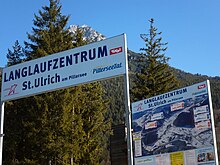
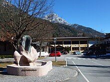
St. Ulrich am Pillersee (locally also: Nuarach ) is a municipality with 1874 inhabitants (as of January 1, 2020) in the Kitzbühel district in Tyrol ( Austria ). The community is located in the judicial district of Kitzbühel .
geography
St. Ulrich am Pillersee is located at 847 meters above sea level on the eponymous Pillersee in the Pillerseetal in the western shadow of the Loferer Steinberge .
Community structure
The municipality covers 52.0 km², of which 7.6 km² are populated. 23.9% (1243 ha) of the community area is used for agriculture, mainly for cattle breeding. 49.2% of the community area, which corresponds to 2560 ha, is covered with forest, which is mainly used for forestry purposes. 1.3% (69 hectares) are built on, the populated area is 7.6 km², which corresponds to 14.6% of the municipal area. The highest point in the municipality is at 2506 meters above sea level on the summit of the Großer Hinterhorn (Mitterhorn).
Neighboring communities
- Fieberbrunn
- St. Jacob in house
- Hochfilzen
- Waidring
- St. Johann in Tirol
- Kirchdorf in Tirol
- Lofer
- Saint Martin near Lofer
history
The first settlement, archaeologically verifiable through row graves, probably took place in the 10th century by Bavarian tribes. The Hofmark Pillersee was settled in the 12th century by Benedictine monks from the Rott am Inn monastery . Ortisei was the original parish of the entire valley. The area was first mentioned in writing in 1151 ( "totum Bileresse cum ecclesia eiusdem loci, decimis et appenditiis suis" ) in a certificate of ownership from Pope Eugene III. for the Rott Monastery. The name of the place derives from St. Ulrich von Augsburg , after whom the parish was named. In 1377 the inn on the street was mentioned in writing as the only inn in the Pillerseetal at that time. In 1401 the late Gothic pilgrimage church was mentioned in a document. In 1506 the Hofmark Pillersee came to the Kitzbühel district court through a regional reform and thus became part of Tyrol, although the Rott monastery remained the owner of the Hofmark. In 1803 the Rott monastery was dissolved and St. Ulrich fell to the Tyrolean sovereign. Between 1911 and 1931 a road was built through the Pillerseetal (asphalted in 1961), which increased the accessibility of the valley and led to an economic connection. In 1969 a ski area was opened on the Buchensteinwand local mountain .
Population development

politics
The municipal council has a total of 13 members.
- With the municipal council elections 2010, the municipal council had the following distribution: 5 We Nuaracher, 5 Together for Ortisei, 3 Livable Ortisei.
- With the municipal council and mayor elections in Tyrol 2016 , the municipal council has the following distribution: 7 Together for Ortisei and 6 We Nuaracher for Ortisei.
- mayor
- until 2009 Kaspar Mettler (party for Ortisei, farmers - workers - economy)
- 2009-2010 Mario Horngacher
- since 2010 Brigitte Lackner
economy
Due to its peripheral location, there is no major industrial settlement in Ortisei. There are 76 commercial enterprises. The majority of the population lives from agriculture (49 farms) and tourism (1700 guest beds / 240,449 overnight stays). Winter sports are of primary importance here. St. Ulrich has its own small ski area, which is connected to the Pillerseetal ski network. Over 83% of the guests spend the night in private accommodation such as guest houses or holiday apartments. Unemployment is 5% (as of 2001), the average income is 16,912 euros / year. 21.1% of the employed work in the manufacturing industry, 33.9% work in transport, storage and communications and 19.7% in the hotel and restaurant industry. It should be noted here that a significant proportion of the employees are out-commuters who are employed in the near or further surrounding area. In 2001, for example, the number of jobs on site, with the exception of those employed in agriculture or forestry, was just 89 out of 608 employees.
traffic
- Street: The Pillerseestrasse (L 2), which connects the B 178 and the B 164 , leads through St. Ulrich .
- Bus: A regional bus runs for several hours between the villages of the Pillerseetal in summer, and a free ski bus runs at a higher frequency in winter.
- Train: The nearest train station is in Fieberbrunn ( Salzburg-Tiroler Bahn ).
education
Ortisei has a kindergarten and a four-level elementary school.
Culture and sights
- Parish church St. Ulrich am Pillersee: Baroque parish church of St. Ulrich with rectory, it once belonged to the Rott am Inn monastery . First mentioned in 1151, tower with Romanesque building core, consecrated as a Gothic church in 1506, redesigned in Baroque style in the 17th and 18th centuries, redesigned in neo-Gothic style in 1865/66, rebaroque in 1960/61
- Filial church St. Adolari : the small church is located in the hamlet of Adolari at the northern end of the Pillersee. In 1957, during renovation work in the choir, frescoes from the 14th century were exposed and restored.
- Ortisei has the world's oldest pine oil distillery .
- A walkable summit cross was opened as a tourist attraction on the Buchensteinwand on July 27, 2014 ( Jakobskreuz ).
Personalities
Honorary citizen
- 2012: Hans Simair (1912–2019), Mayor of St. Ulrich am Pillersee 1962–1971
Personalities associated with the community
- Wolfgang Falck (1910–2007), German fighter pilot
- Nana Gualdi (1932–2007), Italian-German singer and actress
literature
- Chronicle of St. Ulrich am Pillersee. Ed .: Municipality of St. Ulrich am Pillersee. Werner Köfler. - Ortisei aP: Ortisei community, around 1977, 66 pp.
- St. Ulrich am Pillersee, Tyrol . - 4th edition. Salzburg: Verlag St. Peter, 1987. - 12 pp. (Christian Art Centers Austria; No. 25)
Web links
- 70417 - St. Ulrich am Pillersee. Community data, Statistics Austria .
Individual evidence
- ↑ The official spelling is specified or shown in the list of Tyrolean municipalities in the appendix to the Tyrolean municipal code 2001; accessed on April 11, 2012 and on Statistics Austria: A look at the community
- ↑ Martin Bitschnau , Hannes Obermair : Tiroler Urkundenbuch, II. Department: The documents on the history of the Inn, Eisack and Pustertal valleys. Vol. 2: 1140-1200 . Universitätsverlag Wagner, Innsbruck 2012, ISBN 978-3-7030-0485-8 , p. 72, no. 464 .
- ↑ Pine oil distillery, with the opportunity to visit
- ↑ https://www.kitzanzeiger.at/Alt-Dorfchef-starb-mit-106-Jahren_pid,17070,nid,109351,type,newsdetail.html , accessed on April 19, 2019.


