
Grießenpass
| Grießenpass ( valley watershed ) |
|||
|---|---|---|---|
 Pass Grießen, pass summit, view to the west to the magnesite hut in Hochfilzen |
|||
| Compass direction | west | east | |
| height | 975 m above sea level A. | ||
| district | Kitzbühel | Zell am See | |
| Watershed | Fieberbrunner Ache | Leoganger Ache | |
| Valley locations | Fieberbrunn | Leogang | |
| expansion |
164 Hochkönig Strasse Salzburg-Tiroler-Bahn |
||
| Mountains | Kitzbühel Alps | ||
| profile | |||
| Ø pitch | 2.8% (195 m / 7 km) | 1.6% (187 m / 12 km) | |
| map | |||
|
|||
| Coordinates | 47 ° 27 '29 " N , 12 ° 38' 25" E | ||

The Grießenpass or Pass Grießen is the high valley between the Kitzbühel Alps and the Leoganger Steinberge . Another historical, albeit ambiguous, name is Hochfilzensattel .
geography
The Grießenpass connects the communities of Hochfilzen in Tyrol and Leogang in Salzburg with one another, but lies entirely in the Salzburg area. It reaches its highest point at 975 m above sea level about one kilometer south-east of Hochfilzen . A. At the apex of the valley floor ( valley watershed ) lie the Grießensee and the Grießener Moor , from which the names of the two closest towns, Hochfilzen and Grießen, and thus the names of the pass, are derived: Bavarian "Gries" stands for shore sand, "Filz" for Moor.
traffic
Since the Congress of Vienna , the Grießenpass has been one of the lowest connections within Austria between Tyrol and the north-eastern parts of the national territory, including Upper and Lower Austria .
The Salzburg-Tiroler Bahn , also known as the “Giselabahn”, runs over the saddle . Parallel to this runs on the southern side of the valley the Hochkönig road B 164, on the northern side of the valley there is a continuously paved bike path.
history

The marshy top of the pass formed the border between Salzburg and Tyrol at an early stage. Since both countries competed strongly with each other, this was strongly fortified.
A fortified pass was first mentioned in a document in 1424:
"Archbishop Eberhard III. hands over the lake in the Werung im Pintzgew to the brothers Hansen and Marien Ramseiden in Saalvelden and iren 6 legal Sunen ... "
In 1525 peasants occupied the pass. In 1636, the fortifications were reinforced by order of Archbishop Paris Lodron , four years later he had a hill built by the cathedral builder Solari .
In the 17th century, the Grießenpass was one of the passes with the help of which one could avoid expensive tolls , customs duties or even annoying trade restrictions. To counter this, the Salzburg side had a guard stationed at the top of the pass. Thanks to appropriate extensions, the route over the Grießenpass developed into a busy route. The transport of catfish was particularly brisk, and in the 18th century also the popular Etsch brandy .
When Salzburg came to Austria after the Congress of Vienna , the pass became militarily meaningless and the fortifications were left to decay. In 1858, the Vogt von Hochfilzen received permission to break stones in the ruins that were used to build the Hochfilzen church.
During the construction of the railway line from 1873 to 1875, the last remains of the fortifications were removed and used as building material.
Oddities
At the top of the pass there is a sign with the wrong height indication "1000 m above sea level".
photos
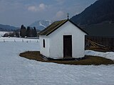
Chapel on the Grießenpass

Between Grießenpass and Leogang


Web links
- Grießenpass at Alpenpassbiker.de
Individual evidence
- ↑ Griesz. In: Jacob Grimm , Wilhelm Grimm (Hrsg.): German dictionary . tape 9 : Greander gymnastics - (IV, 1st section, part 6). S. Hirzel, Leipzig 1935 ( woerterbuchnetz.de ).
- ↑ felt 2.). In: Jacob Grimm , Wilhelm Grimm (Hrsg.): German dictionary . tape 3 : E – research - (III). S. Hirzel, Leipzig 1862 ( woerterbuchnetz.de ).
- ↑ a b c Information board in the Mining and Gothic Museum in Leogang
- ↑ Steffan Bruns: Alpine passes - from the mule track to the base tunnel . Volume 4
- ↑ Pass Grießen. (PDF) In: ortsgeschichte-leogang.at. Municipality of Leogang, p. 366 , accessed on October 15, 2017 .
Ahorn • Alpl • Ammer • Annaberg • Arlberg • Ascher • Bieler • Birkfelder • Boding • Brenner • Buchauer • Buchener • Dientner • Dürrholzer • Eibegg • Erb • Eisental • Faschina • Feistritz • Fern • Filzen • Flattnitz • Flexen • Forsthof • Furka • Fuscher • Gaberl • Gaden wide • Gailberg • Gangleit • Geiseben • Gerichtsberg • Gerlos • Geschriebenstein • Goller • Grießen • Griffner • Large Kripp • Grubberg • Grünbacher • Gschuett • Hafner • Hahntenn • neck • Haselrast • Hebalm • stallion • Hengstl • Hiaslegg • Hirschegger • Hochegger • Hochrindl • Hochtannberg • Hochtor • Holzleiten • Iselsberg • Josefsberg • Kaiserauer • Cold Kuchl • Kartitscher • Katsch • Kernhofer • Kerschbaumer • Klachauer • Klamm • Klamml • Small Kripp • Klippitz • Klostertaler • Kraxen • Kreuth • Kreuzberg • Kühtai • Lahn • Lienbach • Loibl • Losen • Luft • Mendling • Michelbühel • Moarigraben • Nassfeld • Neumarkter • Niederalpl • Norberts • Nöring • Obdacher • Oberjoch • Och • Pack • Paulitsch • Perchauer • Pfaffen • Pfarralm • Pielachtaler • Piller • Plöcken • Pogusch • Pölshals • Pötschen • Präbichl • Prebersattel • Preiner • Pretal • Promau • Pyhrn • Radl • Radling • Radstädter • Radstatt • Rams • Raneck • Rechberg • Rieder • Rohrer • Sattler • Saurüssel • Schaida • Schanz • Scharflinger • Schiestel • Schober • Schönfeld • Schwarze Sau • Schwarzenbichl • Seeberg • Seefelder • Semmering • Kleiner Semmering • Sieggraben • Silzer • Soboth • Summer • Staller • Styrian Seeberg • Straßegg • Sölk • Thurn • Timmels • Triebener Tauern • Turracher • Origin • Wechsel • Weinebene • Weißenbacher • Wagrainer • Windische • Wurzen • Zellerrain