
Hochrindl
| Hochrindl | |||
|---|---|---|---|
 View from Hochrindl to the west on the Falkert |
|||
| Compass direction | west | east | |
| Pass height | 1561 m above sea level A. | ||
| state | Carinthia | ||
| Valley locations | Reichenau plain | Sirnitz | |
| expansion | Landesstrasse 65 | ||
| Mountains | Nockberge | ||
| map | |||
|
|||
| Coordinates | 46 ° 51 '44 " N , 13 ° 59' 48" E | ||

The Hochrindl ( 1561 m ) is an alpine pass as well as an alpine pasture and ski area in the Nock Mountains in Carinthia between level Reichenau and Sirnitz . The state road 65 leads over the pass. Most of the area and all settlements in the area belong to the municipality of Albeck . The landscape, which was largely uninhabited until the middle of the 20th century and characterized by alpine farming , has changed fundamentally in recent decades as a result of increasing summer and winter tourism. Today there are four villages on the Hochrindl (Hochrindl, Hochrindl-Alpl, Hochrindl-Kegel and Hochrindl-Tatermann), which owe their existence almost exclusively to the tourist development of the barren area with poor infrastructure.
More artificial snow planned from 2019/2020
The previous storage pond holds 10,000 m 3 of water for the production of artificial snow and loses the permit after 10 winter seasons in 2019.
A crowdfunding campaign , which runs from December 1, 2018 to the end of February 2019, is to be used to co-finance the construction of a new, 75,000 m 3, much larger storage pond by the population with 300,000 euros. Around 2.2 million out of 2.5 million euros in total costs are covered by private investments and support from the state, neighboring communities and the tourist association. The campaign was initiated by the management consultant Alexandra Bresztowanzsky, who bought the ski area in 2017. An information event was held on December 8th.
photos
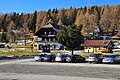
Parking lot with ski school

Signpost to hostels

Late autumn on Hochrindl

Alpine pasture in front of Hochrindl-Kegel

Riapl hut


Tatarmandl's story
Sirnitz was visited twice - in 1476 and 1478 - by the Turkish hordes. The wooden figure of the “Tatarmandl” is reminiscent of the furthest advance of a Tatar heap.
Web links
Individual evidence
- ↑ Crowdfunding campaign for the orf.at ski area , December 9, 2018, accessed December 9, 2018.
- ^ Hochrindl-Neuschnee website of the fundraising campaign, accessed December 9, 2018.
- ↑ Hochrindl-Neuschnee website for crowdfunding
Ahorn • Alpl • Ammer • Annaberg • Arlberg • Ascher • Bieler • Birkfelder • Boding • Brenner • Buchauer • Buchener • Dientner • Dürrholzer • Eibegg • Erb • Eisental • Faschina • Feistritz • Fern • Filzen • Flattnitz • Flexen • Forsthof • Furka • Fuscher • Gaberl • Gaden wide • Gailberg • Gangleit • Geiseben • Gerichtsberg • Gerlos • Geschriebenstein • Goller • Grießen • Griffner • Large Kripp • Grubberg • Grünbacher • Gschuett • Hafner • Hahntenn • neck • Haselrast • Hebalm • stallion • Hengstl • Hiaslegg • Hirschegger • Hochegger • Hochrindl • Hochtannberg • Hochtor • Holzleiten • Iselsberg • Josefsberg • Kaiserauer • Cold Kuchl • Kartitscher • Katsch • Kernhofer • Kerschbaumer • Klachauer • Klamm • Klamml • Small Kripp • Klippitz • Klostertaler • Kraxen • Kreuth • Kreuzberg • Kühtai • Lahn • Lienbach • Loibl • Losen • Luft • Mendling • Michelbühel • Moarigraben • Nassfeld • Neumarkter • Niederalpl • Norberts • Nöring • Obdacher • Oberjoch • Och • Pack • Paulitsch • Perchauer • Pfaffen • Pfarralm • Pielachtaler • Piller • Plöcken • Pogusch • Pölshals • Pötschen • Präbichl • Prebersattel • Preiner • Pretal • Promau • Pyhrn • Radl • Radling • Radstädter • Radstatt • Rams • Raneck • Rechberg • Rieder • Rohrer • Sattler • Saurüssel • Schaida • Schanz • Scharflinger • Schiestel • Schober • Schönfeld • Schwarze Sau • Schwarzenbichl • Seeberg • Seefelder • Semmering • Kleiner Semmering • Sieggraben • Silzer • Soboth • Summer • Staller • Styrian Seeberg • Straßegg • Sölk • Thurn • Timmels • Triebener Tauern • Turracher • Origin • Wechsel • Weinebene • Weißenbacher • Wagrainer • Windische • Wurzen • Zellerrain