Pass Gschütt
| Pass Gschütt | |||
|---|---|---|---|
|
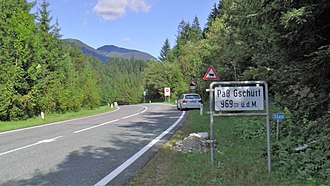
Incorrect labeling at the top of the pass, facing east. |
|||
| Compass direction | west | east | |
| Pass height | 957 m above sea level A. | ||
| state | Salzburg | Upper Austria | |
| Watershed | Lammer → Salzach → Inn → Danube | Gosaubach → Hallstätter See → Traun → Danube | |
| Valley locations | Russbach am Pass Gschütt | Gosau | |
| expansion | Pass Gschütt Straße (B166) | ||
| Mountains | Salzkammergut Mountains (north) Dachstein Mountains (south) | ||
| profile | |||
| Ø pitch | 4.6% (144 m / 3.1 km) | 8.5% (221 m / 2.6 km) | |
| Max. Incline | 13% | ||
| map | |||
|
|
|||
| Coordinates | 47 ° 35 '29 " N , 13 ° 30' 20" E | ||
The Gschütt Pass is an Alpine pass in Austria on the border between Salzburg and Upper Austria . The pass height is 957 m above sea level. A. . It connects the Salzburg Russbach am Pass Gschütt in the Lammertal ( Hallein district ) with the Upper Austrian Gosau in the Inner Salzkammergut ( Gmunden district ) and separates the Salzkammergut Mountains in the north from the Dachstein Mountains in the south.
Pass Gschütt Straße (B166) leads over the pass , in the south is the Dachstein-West ski region .
history
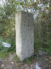
Between 1564 and 1583 a border treaty was negotiated here between the Archdiocese of Salzburg and Upper Austria and a corresponding boundary stone was erected in 1567. The guard house at the pass was given as a farmer's fief in the archbishop's court arbor . The owner was obliged to keep the barrier bar locked and to keep transport lists for wine, cattle and lard. In the case of military needs, he had to leave the house for a fee.
In 1731 the old house was demolished and rebuilt on better ground. In 1777 the crew was reinforced because smuggling had become rampant. In 1791 the entrance and exit were blocked with two gates attached to columns. Because of its poor condition, the road could only be used for salt transports in winter. However, the farmers of Russbach always went to the Protestant Gosau to worship on Sundays .
With the secularization , the pass building passed into private ownership.
Individual evidence
- ↑ a b Surroundings of Pass Gschütt on ÖK 50 , www.austrianmap.at , Federal Office for Metrology and Surveying Austria, Austrian map.
literature
- Friederike Zaisberger & Walter Schlegel : Castles and palaces in Salzburg. Flachgau and Tennengau . Birch series, Vienna 1992, ISBN 3-85326-957-5 .


