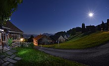
Loose pass
| Loose pass | |||
|---|---|---|---|
|
The Losenpass with the pass road from Lank |
|||
| Compass direction | west | east | |
| Pass height | 1139 m above sea level A. | ||
| state | Vorarlberg ( Austria ) | ||
| Watershed | Dornbirn Ach → Rhine | Bregenz Ach → Rhine | |
| Valley locations | Dornbirn | Schwarzenberg | |
| expansion | Bödelestrasse (L 48) | ||
| Mountains | Bregenz Forest Mountains | ||
| Map (Vorarlberg) | |||
|
|
|||
| Coordinates | 47 ° 25 '22 " N , 9 ° 48' 33" E | ||
The Losenpass is an alpine pass in the Bregenz Forest Mountains with a height of 1139 m above sea level. A. It is located in the Bödele area in the Austrian state of Vorarlberg and connects the city of Dornbirn in the Rhine Valley with the community of Schwarzenberg in the Bregenz Forest .
The terms Losenpass and Bödele are often used synonymously with regard to the pass road .
Northeast of the pass is the Geißkopf ( 1198 m above sea level ), south of the Hochälpelekopf ( 1463 m above sea level ).
Individual evidence
- ↑ a b Austrian Map online 1: 50,000 (ÖK 50) of the BEV


