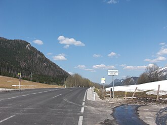
Buchauer saddle
| Buchauer saddle | |||
|---|---|---|---|
|
|
|||
| Compass direction | southwest | Northeast | |
| Pass height | 861 m above sea level A. | ||
| state | Styria | ||
| Watershed | Wengerbach, Enns | Buchauer Bach, Großer Billbach, Enns | |
| Valley locations | Weng in the Gesäuse | St. Gallen | |
| expansion | Buchauer Strasse (B 117) | ||
| Mountains | Ennstal Alps | ||
| profile | |||
| Ø pitch | 7.3% (220 m / 3 km) | 3% (346 m / 11.5 km) | |
| map | |||
|
|
|||
| Coordinates | 47 ° 36 '38 " N , 14 ° 31' 4" E | ||
The Buchauer saddle is 861 m above sea level. A. high pass in the Ennstal Alps in Styria . Buchauer Straße (B 117) leads over the saddle from Altenmarkt to Admont .
The Buchauer Sattel separates the Großer Buchstein from the Haller walls and the Middle Ennstal from the valley of the Großer Billbach , which flows into the Upper Austrian Ennstal near Altenmarkt . The pass is the starting point for hikes to the Grabneralmhütte and the Admonter Haus . Road bike or mountain bike tours also lead over the Buchauer Sattel.
In the last Ice Age , the Enns Glacier built up at the narrow point of the Gesäuses and flowed over the Buchauer Saddle into the Buchau , as evidenced by extensive moraine deposits . So it is a transfluence passport .
literature
- Arthur Winkler-Hermaden : Geological play of forces and land formation. Basic knowledge on the question of young mountain formation and land formation. Springer, Vienna 1957, p. 578, doi : 10.1007 / 978-3-7091-7881-2 .
Individual evidence
- ↑ ÖK50 in: www.austrianmap.at , Federal Office for Metrology and Surveying Austria, Austrian map.
- ↑ Buchauer Sattel, access to the Grabneralmhütte in: www.grabneralmhaus.at , accessed on August 7, 2017.
- ↑ Buchauer Sattel (861m) in: www.quaeldich.de , accessed on August 7, 2017.
- ↑ Gesaeuse National Park : Geology of the Gesaeuse , accessed on August 19, 2019.

