Preiner Gscheid
| Preiner Gscheid | |||
|---|---|---|---|
|
|
|||
| Compass direction | east | west | |
| Pass height | 1070 m above sea level A. | ||
| district | Neunkirchen , Lower Austria | Bruck-Mürzzuschlag , Styria | |
| Watershed | Rettenbach / Preiner Bach (→ Schwarza ) | Raxenbach (→ Mürz → Mur ) | |
| Valley locations | Reichenau on the Rax | Chapels | |
| expansion | Preiner Gscheid state road | ||
| Mountains | Rax Schneeberg Group | ||
| profile | |||
| Ø pitch | 4.6% (586 m / 12.8 km) | 3.7% (367 m / 10.0 km) | |
| map | |||
|
|
|||
| Coordinates | 47 ° 40 '33 " N , 15 ° 43' 23" E | ||
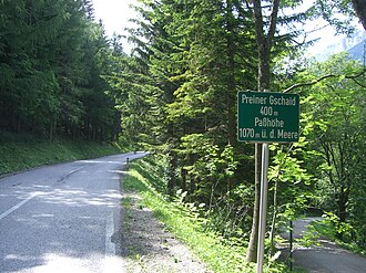
The Preiner Gscheid ( 1070 m above sea level , also Preiner Gschaid ) is a mountain pass parallel to the Semmering Pass .
Location and landscape
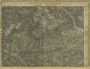
The pass connects the Lower Austrian middle Schwarzatal with the Styrian Upper Mürz Valley . On the southern roof of the Rax, it crosses the wooded ridge that runs south over the Tratenkogel ( 1565 m above sea level ) in the Semmering area to the southeastern Semmering Pass. The border between Lower Austria and Styria runs over the Preiner Gscheid .
Pass road L135 / L103
The pass road, the L135 / L103 , connects the villages of Reichenau an der Rax and the village of Prein an der Rax of this Reichenau community at the foot of the pass ( Höllental Straße B27 next Hirschwang via Edlach - Dörfl ) with chapels on the Styrian side ( Lahnsattelstraße B23) .
It has a maximum gradient of 11%.
Pass height
At the top of the pass there is a car park and the Edelweißhütte inn .
There is also the Marian column on Preiner Gscheid ( Lage ), a wayside shrine. It was erected under the abbot of the Cistercian Abbey of Neuberg , Balthasar II. Huebmann von Neuberg , as a border stone between Austria and Styria . It is dated 1654. The pillar (stele) in relief shows a coat of arms cartouche with the coat of arms of Neuberg all around - an uncial M decorated with a cross - and above it the donors ' initials B: A: Z: N, a cartouche with the slogan “ PROTEGE DEFENDE ” (' protect and defend ') and the date, the initials , a putti head and high reliefs of Saint Mary . It is a listed building .
ways

The Preiner Gscheid is the junction and starting point of several hiking trails. The Rax stage of the European long-distance hiking trail E4 begins here . The following huts are easy to reach on the Rax:
- Waxriegelhaus , walking time: about 50 minutes
- Seehütte via the Göbl-Kühn-Steig , walking time: about 2 hours
- Karl-Ludwig-Haus via Schlangenweg , walking time: around 2 hours
The Scheibenhütte on the Großer Platte ( 1473 m above sea level ) is about five kilometers southwest of the pass.
In winter, Preiner Gscheid is the starting point for the popular ski tour through Karlgraben to the Rax plateau.
Web links
Individual evidence
- ^ Rax Heukuppe - Karlgraben . ( Page no longer available , search in web archives ) Info: The link was automatically marked as defective. Please check the link according to the instructions and then remove this notice. Tour description on bergstieg.com
Remarks
- ↑ The address is on Am Preiner-Gschaid .
-
↑ cf. Elga Lanc: Corpus of medieval wall paintings in Austria. Volume 2, Styria , Volume 1, Verlag der Österreichischen Akademie der Wissenschaften, 2002, ISBN 978-3-7001-3006-2 , p. 295;
The picture can be found in the municipal coat of arms of Neuberg . - ↑ dissolvable as "Balthasar Abt zu Neuberg".


