
Gscheidlhöhe
| Gscheidlhöhe (Gscheidl) | |||
|---|---|---|---|
| Compass direction | east | southwest | |
| Pass height | 1134 m above sea level A. | ||
| region | Semmering – Rax , industrial district , Lower Austria | Bruck – Mürzzuschlag , Upper Styria , Styria | |
| Watershed | Preinbach → Schwarza → Leitha → Danube | Silence Mürz → Mürz → Mur → Drau → Danube | |
| Valley locations | Preintal , Gem. Schwarzau in the mountains | Frein an der Mürz , Gem. Mürzsteg | |
| expansion | Footpath (Zellersteig, WW06 ) | ||
| Mountains | Göller-Gippel-Zug / Sonnleitstein Group | ||
| particularities | on the south-west side still goes over Lower Austrian territory, therefore not on the state border; historical flood tunnel (av.) | ||
| profile | |||
| Ø pitch | 14.2% (497 m / 3.5 km) | 2.6% (270 m / 10.5 km) | |
| Map (Lower Austria) | |||
|
|||
| Coordinates | 47 ° 47 '19 " N , 15 ° 36' 25" E | ||

The Gscheidlhöhe , often short Gscheidl (Gscheid is a local name for 'Joch': 'little pass') is 1134 m above sea level. A. high mountain pass between the Lower Austrian Schwarzatal and the Styrian Mürz Valley .
location
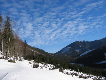
The Gscheidlhöhe is on the south side of the Gippel ( 1669 m above sea level ) and forms the transition to the Donnerkogel ( 1617 m above sea level ), a northern side mountain of the Großer Sonnleitstein . The summit directly south of the yoke is called Lahnberg ( 1594 m above sea level ), the north is Perschkogel ( 1612 m above sea level ).
The pass connects the Preintal , a town of Schwarzau in the mountains , with Frein an der Mürz , municipality of Mürzsteg . In the meantime, however, it still goes over Lower Austrian territory on the southwest side, namely the rulership grounds that belong as an orographic exclave to St. Aegyd am Neuwalde , north of the Göller-Gippel train . It is therefore not on the Lower Austria – Styria border, but on the Neunkirchen – Lilienfeld district border . The location there is also called Gscheidl .
The Preinbach drains from the Gscheidlhöhe via the Schwarza to the Leitha , and the Stille Mürz , one of the source streams of the Mürz to the Mur . The watershed runs north onto the Gippel wall .
History: development and paths
The ruling grounds were an old sovereign hunting ban , one of the largest Dominical holdings in Austria at the time, and the Hochreith hunting lodge (today the municipality of Rohr ) also belongs to the wider area .
It was not until the 1810s that the timber entrepreneur Georg Huebmer (Hubmer) , the "Raxkönig", received permission to use parts of the forest for forestry purposes. Hubmer had started to deliver wood on a large scale in Hoyos 's Schwarzau to the Innerberg main trade union and then also to Vienna , and had set up extensive flooding systems (drift canals, Klausen and rakes) for this . When the forests of the Naßwald were exhausted, Hubmer had to move to more and more distant forests in the Mürz catchment area. From 1811, and after the interruption by the Napoleonic Wars again from 1822, a 430 meter long flood tunnel was blown through a little south under the Gscheidl. The tunnel workers digging from both sides at the same time met in 1827. It was the longest tunnel in Austria at the time, even though Hubmer had no training as a forest worker. Now water from the Zöchtlingbach could be caught and wood could be harvested for the Schwarza.
Later, a real small settlement was built, the St.-Aegyder Gscheidl , at times with its own school, and an inn, a wooden elevator to access lower-lying areas, and above a second, longer tunnel (760 meters), the Hubmer's grandson Georg (II.). From the First World War, the timber industry was stopped and the settlement increasingly abandoned. Both tunnels have collapsed, the silted up alluvial channels can still be traced into the Schwellgraben. Parts of the woodworkers' settlement on Gscheidl have been preserved. Only a remnant of the former primeval forest on the Gscheidl remains today, the Neuwald , known as the Lahnsattler primeval forest . The rest of the area around the Gscheidlhöhe is today forest without any special features.
In the late 19th century, Emperor Franz Joseph also made public access possible in order to promote the pilgrimage to Mariazell , to the Mater Austriae. In 1893 the Alpine Club marked the Zellersteig Gscheidlhöhe - Lahnsattel , but at the time it was still strictly forbidden to leave the path. Today the east branch of the Austrian long-distance hiking trail 06, the Mariazellerweg , leads over the Gscheidlhöhe .
literature
- Bernd Gabriel: The logging systems on the Preintaler Gscheidl - forgotten masterpieces of alpine engineering. In: Österreichische Ingenieur- und Architekten-Zeitschrift, vol. 128 (1983), issue 10, pp. 378–382.
Individual evidence
- ↑ The pass no longer belongs to the main Alpine ridge . One kilometer north, on the east shoulder of the Gippel, is the watershed triple point Traisen and Mürz zur Leitha, which already drains primarily eastwards. The main Alpine ridge is usually calculated over the Vienna Woods to the Wiener Pforte on Leopoldsberg.
- ↑ Heiner Eichner, Otto Back, Peter Ernst, Sergios Katsikas: Language standardization and language planning. Festschrift for Otto Back on his 70th birthday; with articles from the fields of graphematics, orthography, onomatology, Austrian German, language standardization and planned language studies, 2nd edition, Verlag Edition Praesens, 1996, p. 161 f.
- ^ Fritz Lange: From Dachstein to Rax - In the footsteps of Georg Hubmer. Sutton Verlag, 2007, ISBN 978-3-86680-184-4 ( limited preview in Google book search).
- ↑ a b Photo Lange, 2007, p. 96.
- ↑ Lange, 2007, p. 101.
- ↑ Photo Lange, 2007, p. 94.
- ↑ The Neuwald is different from the Rothwald (which had a similar orographic exclave location) because it is freely accessible, not a real primeval forest in the sense of a nature reserve. In detail in K. Zukrigl, G. Eckhart, J. Nather: Locational and silvicultural investigations in primeval forest remnants of the Lower Austrian Limestone Alps. = Notices from the Federal Forest Research Institute Mariabrunn 62, 1963, p. 9
- ↑ cf. Photo, Martin Nessl, 2009, for the tour description, martinnessl.info
- ↑ Mitteilungen des Deutschen und Oesterreichischen Alpenverein , Volume 19, 1893, p. 154, column 2 ( limited preview in the Google book search).