Nöringsattel
| Nöringsattel | |||
|---|---|---|---|
|
|
|||
| Compass direction | south | North | |
| Pass height | 1661 m above sea level A. | ||
| district | Spittal an der Drau | Spittal an der Drau | |
| Watershed | Globatschbach → Kaningbach → Riegersbach → Millstatt | Nöringbach → Lieser | |
| Valley locations | Radenthein , OT Kaning | Iron rats | |
| expansion | Back road | ||
| Mountains | Nockberge | ||
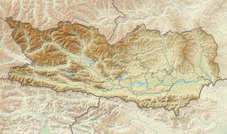
| Map (Carinthia) | |||
|
|
|||
| Coordinates | 46 ° 51 '19 " N , 13 ° 37' 44" E | ||
The Nöringsattel is a mountain pass in the Nock Mountains between the Nöringgraben and Kaning. It is located between the Rabenkofl and Kampelnock peaks.
Individual evidence
- ↑ The Millstätter Alpe magnesite deposit near Radenthein. (PDF; 10.9 MB) Retrieved April 23, 2013 .

