Judgment Hill
| Judgment Hill | |||
|---|---|---|---|
|
|
|||
| Compass direction | west | east | |
| Pass height | 581 m above sea level A. | ||
| state | Lower Austria | ||
| Watershed | Gerstbach → Gölsen → Traisen | Spiegelbach → Kaumbergerbach → Triesting | |
| Valley locations | Hainfeld | Kaumberg | |
| expansion | Hainfelder Strasse (B 18) | ||
| Mountains | Gutenstein Alps / Vienna Woods | ||
| profile | |||
| Ø pitch | 2.1% (142 m / 6.7 km) | 2.7% (87 m / 3.2 km) | |
| Map (Lower Austria) | |||
|
|
|||
| Coordinates | 48 ° 1 '47 " N , 15 ° 51' 27" E | ||
The court mountain is a 581 m above sea level. A. high pass in Lower Austria between the Triestingtal and the Gölsental .
Location and landscape
The Richtberg is located about 45 kilometers southwest of the center of Vienna . It is an inconspicuous saddle of the Gölsen-Triesting furrow , which cuts through the main ridge of the northern Alps that run out towards Vienna . It connects Kaumberg on the upper Triesting in the east with Hainfeld (Lower Austria) on the Gölsen in the west. Directly at the pass, the village attracts Hainfelder Gerichtsberg southeast.
The valley pass forms the watershed between the drainage to the east into the Vienna Basin and the Leitha , and to the north into the Alpine foothills over the Traisen . The Richtberg separates the Vienna Woods in the northeast from the Gutenstein Mountains and the entire Gutenstein Alps in the south.
History and traffic

The pass opens up a simple connection from today's Lower Austrian central area around Sankt Pölten , as well as the Eisenwurzen (which already begins with the iron industry around Hainfeld) and Upper Styria , with the area south of Vienna around Baden and Wiener Neustadt , the industrial district , with a simultaneously simple one Connection to Vienna via Heiligenkreuz , and thus an important route from the city to the inner Eastern Alps. Therefore it has formed an important east-west connection since ancient times. The historic Via Sacra , the pilgrimage route from Vienna to Mariazell , runs over this pass here. On the other hand, the pass also forms a gateway from the east, the Hungarians devastated the valley after the Battle of the Leitha in 1246, and in 1529 the Turks during the First Turkish Siege of Vienna .
Politically, the pass between Lilienfeld Abbey , Mariazell and Göttweig Abbey was fought over during the Middle Ages . The customs barrier was at the Kaumburger Araburg , which is why the name Kaumberg is historically found for the pass. At the pass there was a second barrier to anyone who was caught here without a pass, whose goods were confiscated. The name “Richtberg” is derived from this. There were also executions, the name of the nearby Schandl farmer is said to refer to it ( Schand- , '[public] punishment').
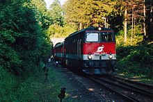
Today the Hainfelder Straße B 18 and the rails of the Leobersdorfer Bahn, which was closed in 2004, run here . A popular shortcut from the West Autobahn and the Wiener Außenring Autobahn to the Süd Autobahn leads across the Richtberg . Since this route was increasingly used by trucks , it was closed to trucks except for local traffic in the Triestingtal and Gölsental.
In spite of its low altitude, the Richtberg mountain often represents a traffic obstacle, especially in winter, as the situation can be much more critical than in the neighboring valleys.
Web links
Individual evidence
- ↑ a b Johann B. Petrossy: The Araberg ruins near Kaumberg in Lower Austria, along with a historical-topographical representation of those markets and towns over which the former owners of this castle exercised their bailiwick rights [...]. Verlag Mayer, Vienna 1875, chapter Hainfeld , p. 30 ff ( digitized version, Google, full view ).
- ↑ Petrossy 1875, chapter Kaumberg , p. 16 ff ( Google ).
- ↑ a b c Petrossy 1875, p. 29 f.

