
Schoberpass
| Schoberpass | |||
|---|---|---|---|
| Compass direction | west | east | |
| Pass height | 849 m above sea level A. | ||
| state | Styria | ||
| Watershed | Palten , Enns | Liesing , Mur | |
| expansion | B113 / A9 / railway line | ||
| Mountains | Lower Tauern / Eisenerzer Alps | ||
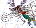
| Map (Styria) | |||
|
|||
| Coordinates | 47 ° 27'5 " N , 14 ° 40'19" E | ||

The Schoberpass in Styria is 849 m above sea level. A. high valley pass that separates the Niedere Tauern from the Eisenerzer Alps . It forms the watershed between Palten ( Enns ) and Liesing ( Mur ), whose common valley furrow culminates today in the Schober Pass. As a typical valley watershed, the transition in the terrain is hardly apparent.
The pass has been an important traffic route since time immemorial, and is - besides the route along the Danube via Vienna and Budapest - the most important connection from north-west Europe via the Balkans to south-east Europe . It also represents the most important inner-Austrian connection between western and southern Austria . In the second half of the 20th century, the pass marked the infamous guest worker route . Today the Rudolfsbahn and the Pyhrn Autobahn (A9) run here . After the Brenner Pass, the Schober Pass is the most important Alpine pass in freight transport with 1.4 million trucks per year. In Alpine transit , however, in recent years since the Balkan Wars , the pass has lost its significance compared to the routes that bypass the Alps completely in the northeast.
Catchment area of the Schober Pass, with source, destination and transit states (the guest worker route of the 1970s, without the former Eastern Bloc)

Individual evidence
- ^ Austria: Alpine state with the most truck traffic. In: traffic RUNDSCHAU. February 22, 2010, accessed April 19, 2010 .
Ahorn • Alpl • Ammer • Annaberg • Arlberg • Ascher • Bieler • Birkfelder • Boding • Brenner • Buchauer • Buchener • Dientner • Dürrholzer • Eibegg • Erb • Eisental • Faschina • Feistritz • Fern • Filzen • Flattnitz • Flexen • Forsthof • Furka • Fuscher • Gaberl • Gaden wide • Gailberg • Gangleit • Geiseben • Gerichtsberg • Gerlos • Geschriebenstein • Goller • Grießen • Griffner • Large Kripp • Grubberg • Grünbacher • Gschuett • Hafner • Hahntenn • neck • Haselrast • Hebalm • stallion • Hengstl • Hiaslegg • Hirschegger • Hochegger • Hochrindl • Hochtannberg • Hochtor • Holzleiten • Iselsberg • Josefsberg • Kaiserauer • Cold Kuchl • Kartitscher • Katsch • Kernhofer • Kerschbaumer • Klachauer • Klamm • Klamml • Small Kripp • Klippitz • Klostertaler • Kraxen • Kreuth • Kreuzberg • Kühtai • Lahn • Lienbach • Loibl • Losen • Luft • Mendling • Michelbühel • Moarigraben • Nassfeld • Neumarkter • Niederalpl • Norberts • Nöring • Obdacher • Oberjoch • Och • Pack • Paulitsch • Perchauer • Pfaffen • Pfarralm • Pielachtaler • Piller • Plöcken • Pogusch • Pölshals • Pötschen • Präbichl • Prebersattel • Preiner • Pretal • Promau • Pyhrn • Radl • Radling • Radstädter • Radstatt • Rams • Raneck • Rechberg • Rieder • Rohrer • Sattler • Saurüssel • Schaida • Schanz • Scharflinger • Schiestel • Schober • Schönfeld • Schwarze Sau • Schwarzenbichl • Seeberg • Seefelder • Semmering • Kleiner Semmering • Sieggraben • Silzer • Soboth • Summer • Staller • Styrian Seeberg • Straßegg • Sölk • Thurn • Timmels • Triebener Tauern • Turracher • Origin • Wechsel • Weinebene • Weißenbacher • Wagrainer • Windische • Wurzen • Zellerrain