Windy height
| Windy height | |||
|---|---|---|---|
|
Windische Höhe, pass summit |
|||
| Compass direction | North | south | |
| Pass height | 1110 m above sea level A. | ||
| state | Carinthia | ||
| Valley locations | Feistritz on the Drau | Sankt Stefan im Gailtal | |
| expansion | L33 Kreuzner Strasse | ||
| profile | |||
| Ø pitch | 3.9% (591 m / 15.0 km) | 7.5% (384 m / 5.1 km) | |
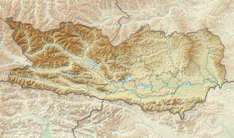
| Map (Carinthia) | |||
|
|
|||
| Coordinates | 46 ° 38 '3 " N , 13 ° 32' 41" E | ||
The Windische Höhe (Slovenian: Ovršje ) is a pass at 1110 m above sea level. A. , which lies on the border between the communities of St. Stefan and Paternion in Carinthia .
This is where the districts of Villach-Land and Hermagor come together, which means that the place is divided into two districts, although it only consists of three houses and a church. The Windische Höhe is also known for its location on the road connection from Gailtal to Drautal ( Sankt Stefan im Gailtal - Feistritz an der Drau ). The pass is also popular as an excursion destination; From here, the summit of the Tschekelock ( 1892 m ) can be reached in two to three hours .
The German name refers to the to the 20th century existing linguistic border between the German Lower Drautal and the still partially Slovene Lower Gailtal (see. Windisch ), while the historic autochthonous Slovenian name (Ovršje) does not represent or that aspect only refers to the hill character (vrh = hill).

