Josefsberg
| Josefsberg | |||
|---|---|---|---|
|
Pass against Ötscher |
|||
| Compass direction | North | south | |
| Pass height | 1012 m above sea level A. | ||
| state | Lower Austria | ||
| Watershed | Lassingbach → Erlauf | Erlauf | |
| Valley locations | Annaberg | Mitterbach | |
| expansion | Mariazeller Strasse (B 20) | ||
| Mountains | Türnitz Alps | ||
| map | |||
|
|
|||
| Coordinates | 47 ° 50 ′ 41 ″ N , 15 ° 18 ′ 52 ″ E | ||
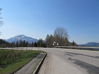
The Josefsberg is 1012 m above sea level. A. high mountain pass in the Türnitz Alps in Lower Austria . It leads over a local watershed of the Erlauf and has the character of a valley pass to bypass the Ötschergräben .
The pass connects the towns of Annaberg and Mitterbach and has a maximum gradient of 10%. The village of the same name is located on the top of the pass.
The ski area Schilifte Josefsberg auf dem Alpl ( 1239 m ), which was founded in 1966 and is east of the village, had four lifts. It has been out of service since the end of the 2011/12 season and has been closed since 2014.
Individual evidence
- ↑ Josefsberg and the surrounding area on ÖK 50 , www.austrianmap.at , Federal Office for Metrology and Surveying Austria, Austrian map.
- ↑ The downhill slopes on Josefsberg at a glance. Retrieved October 31, 2018 .
- ↑ Johannes Weichhart: Ski area does not find a buyer. In: Kurier.at. November 19, 2013, accessed October 31, 2018 .
- ↑ Michael Lang: At Josefsberg 1012m there is time / stopped ... 2017, accessed on October 31, 2018 .

