Ammersattel
| Ammersattel | |||
|---|---|---|---|
|
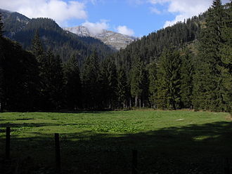
Alpine meadows near the top of the pass |
|||
| Compass direction | southwest | Northeast | |
| Pass height | 1115 m above sea level A. | ||
| state | Tyrol | Bavaria | |
| Watershed | Torsäulenbach, Archbach , Lech , Danube | Neualmbach , Linder , Ammer , Isar , Danube | |
| Valley locations | Reutte | Ettal | |
| expansion | State Road 255 | State Road 2060 | |
| Built | 1852 | ||
| Mountains | Ammergau Alps | ||
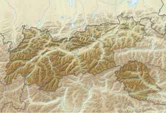
| Map (Tyrol) | |||
|
|
|||
| Coordinates | 47 ° 32 '0 " N , 10 ° 53' 3" E | ||
The Ammersattel is a 1115 m high mountain pass in the Ammergau Alps in Tyrol .
location
The Ammersattel is located in the Austrian Ammerwald about 250 m south of the German border and about one kilometer west of the point where the road is 1083 m above sea level. NHN Höhe crossed the Fischbach in the course of the state border.
The pass road runs between the Hochplatte ( 2082 m ) in the northwest and the Scheinbergspitz ( 1929 m ) in the north as well as the Kreuzspitz ( 2185 m ) in the southeast and the Geierköpf (up to 2161 m ) in the southwest, of which the first three mountains in Germany rise .
history
The road over the Ammersattel was built in the 19th century under King Maximilian II of Bavaria and inaugurated in 1852. A memorial in the village of Plansee, erected there in 1872, commemorates the construction of the road.
traffic
The road leading over the Ammersattel (in Germany: Bayerische Staatsstraße 2060; in Austria: L 255 Planseestraße ) connects Ettal near Oberammergau (in the Garmisch-Partenkirchen district ) and Reutte in Tyrol (in the Reutte district ).
The distance between the two border towns is 35 km, at the steepest point the pass road has a gradient of up to 12%. The mostly curvaceous side road, which is a little more curvy at the top of the pass, branches off the B 23 in Germany near Ettal and in Austria off the Fernpass road (B179) near Reutte . It leads from the northeast through the Graswang valley along the Linder , the upper course of the Ammer , which partly seeps into the permeable, chalky subsoil , over Graswang and past Linderhof Castle up to the top of the pass. On the Austrian side, it leads over Plansee through the valley of the Plansee down to Reutte . Thus, the Ammersattel connects the Ammertal or the east of Ettal preferred Loisachtal with the Lech .
Individual evidence
- ↑ BayernAtlas 1: 25,000 , accessed on March 1, 2018.


