Reed moss saddle
| Reed moss saddle | |||
|---|---|---|---|
|
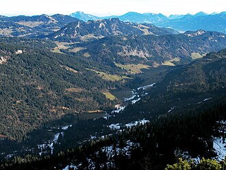
Rohrmoostal with the road from the lower Gottesackewalls |
|||
| Compass direction | west | east | |
| Pass height | 1120 m above sea level NN | ||
| state | Bavaria , Germany | Bavaria , Germany | |
| Watershed | Subersach ( Rhine ) | Starzlach ( Danube ) | |
| Valley locations | Sibratsgfall ( Vorarlberg , Austria ) | Tiefenbach | |
| expansion | Private toll road | ||
| Motor vehicle lock | Summit section for car locked | ||
| Mountains | Allgäu Alps | ||
| particularities | European main watershed | ||
| Map (Bavaria) | |||
|
|
|||
| Coordinates | 47 ° 23 '48 " N , 10 ° 8' 19" E | ||
The Rohrmoossattel is one at 1120 m above sea level. NN located pass height in the Allgäu Alps and part of the European main watershed between Rhine and Danube .
Location and surroundings
The top of the pass lies between the Untere Gottesackerwewall (1857 m) in the south and the Piesenkopf (1630 m). The Rohrmoossattel is located on German territory in the Bavarian district of Oberallgäu . However, the border with the Austrian state of Vorarlberg runs close to the top of the pass: the distance is about three kilometers to the south and about four kilometers to the west. It is named after the nearby hamlet of Rohrmoos , a district of Oberstdorf .
Watershed
The Rohrmoossattel is part of the European main watershed between the Rhine and the Danube. On the western side of the pass, the Achbach flows over the Schönbach into the Rubach , which drains into the Rhine via the Subersach , Bregenzer Ach and Lake Constance . The Starzlach flows to the east and flows over the Breitach and Iller into the Danube.
Development
A continuously paved road runs over the Rohrmoossattel in an east-west direction. It connects the Oberstdorf district of Tiefenbach with the Austrian town of Sibratsgälle in the Bregenz Forest . In the east, however, the road is only open to public transport as far as the junction to Rohrmoos (2.4 kilometers east of the pass summit) and in the west only to the German hamlet of Hirschgund (4.9 kilometers west of the pass summit). In addition, the eastern part of the road is toll . The actual apex route, however, is closed to all motorized individual traffic without exception - barriers on both sides prevent unauthorized persons from passing through. To the north of the toll road, the public road runs over the Riedbergpass (1407 m).
Web links
- Description of the Rohrmoossattels on the Hobby-Radsportseite www.quaeldich.de
- Image documentation of the pass road at www.alpenrennradtouren.de
Individual evidence
- ↑ Bavarian Surveying Administration : BayernViewer 2.0 ( Memento of the original from July 26, 2014 in the Internet Archive ) Info: The archive link was automatically inserted and not yet checked. Please check the original and archive link according to the instructions and then remove this notice. . Retrieved February 17, 2012.

