
Semmering Pass
| Semmering Pass | |||
|---|---|---|---|
 View of the Semmering (in the background: Schneeberg) |
|||
| Compass direction | west | east | |
| Pass height | 984 m above sea level A. | ||
| state | Styria | Lower Austria | |
| Watershed | Fröschnitzbach → Mürz → Mur → Danube | Heidbach → Auebach (Schwarza) → Schwarza → Leitha → Danube | |
| Valley locations | Spital am Semmering | Schottwien | |
| expansion | Landesstraße / Semmering expressway S6 (tunnel) / Semmeringbahn (tunnel) | ||
| map | |||
|
|||
| Coordinates | 47 ° 37 '59 " N , 15 ° 49' 48" E | ||


The Semmering Pass or Semmering for short is 984 m above sea level. A. high mountain pass between the Raxalpe in the north and the Wechsel Mountains in the south. Immediately above the pass is the Hirschenkogel in the south and the Pinkenkogel ( 1292 m above sea level ) in the north . The Semmering forms the natural border between Lower Austria and Styria .
geology
The Semmering area represents a geological window in which older rocks of the Central Alps protrude above younger ones - similar to the Tauern window . In terms of area, however , this Semmering window only covers around 200 km².
In the Semmering area there are the remains of several small mines, in which iron ore, copper and other ores as well as coal were mined from the 16th century to the 19th century.
Naming
The area around the Semmering was probably largely depopulated during the troubled times of the migrations , a fate that it shared with many areas in the eastern Alps. From around the 6th century Slavic tribes were able to immigrate, which also gave the Semmering its name - “Semmerick”, which presumably means something like “the inhospitable”. But there are also other name explanations that speak of other Slavic or even German roots, such as the Slavic names "Smrk" (spruce) or "Cemerinik" (mountain near the snow rose).
When the German settlement of Semmering took over in the 10th century, the German colonists - as elsewhere - took over the old Slavic field names, although it is known that among the German colonists, the German name "Cerewald" (stone pine forest) for a long time Semmering was in use. In the Arthus trip of the minstrel Ulrich von Liechtenstein , he reported on his adventures that happened to him while crossing the "Semernic".
The earliest written evidence is from 1227 and is "Semernic". The name could also go back to the Slovenian cemerika (land with hellebore ).
history
The first mule track over the Semmering was only built in 1160 on behalf of Margrave Ottokar III. created. Until then, traffic between the Vienna Basin and the south ran over the Pittental , along the old Roman road over the Wechsel . This mule track was built around 1735 under Charles VI. replaced by the first Semmeringstrasse. At that time, Schottwien developed into an important stage station for wagons at the beginning of the actual ascent, as additional horses had to be harnessed here to cope with the steep road. Accommodation businesses and the ancillary transport trade (such as blacksmiths, Wagner and saddlers) flourished.
At the beginning of the 19th century, a new route was planned to defuse the dangerous gradients of the old road. A second road connection was built over this route between 1839 and 1841.
From 1842 onwards, there were railway lines from Bruck an der Mur to Mürzzuschlag and from Vienna to Gloggnitz , the gap over the Semmering being closed in 1854 by the Semmering Railway , built by Carl Ritter von Ghega .
From 1956 to 1958, Semmeringstrasse was re-routed a third time and adapted to the increased volume of traffic.
traffic
In addition to the Wechselpass, Semmering is the most important connection between the federal states of Lower Austria and Styria. It can be crossed on the Semmering pass road or on the Semmering expressway S6 as well as with the Semmering railway . At the top of the pass is the climatic health resort of the same name, Semmering . The pilgrimage site of Maria Schutz is not far from the Semmering on the eastern side in Lower Austria, as is Schottwien ; to the west of the pass, Spital am Semmering and Mürzzuschlag are the - Styrian - valley locations .

An addition to the Semmering Railway, which is the world's first high-mountain railway to be protected as a UNESCO World Heritage Site , is being pursued by the Semmering Base Tunnel project, which began construction in April 2012, is 27 km in length and 2 tubes. The project is intended to significantly shorten the travel time from Vienna to Graz, but is controversial due to feared disturbances in the groundwater balance. The tunnel route should not be able to be opened to rail traffic until 2026 (as of 2018).
In October 2004 the Semmering summit tunnel was opened for car traffic. The tunnel, which can be driven without a special toll, is faster and more comfortable than the pass road, so it promotes road traffic that is suitable for expressways. The health resort of Semmering will be relieved of most of the through traffic, which will make a different road design possible, even if the - now - alternative route has to be maintained efficiently. On the other hand, certain business sales are also lost. A redesign of the pass is planned.
Ski Area
The Hirschenkogel ski area is located directly on the pass, to the west of Semmering near Spital das Stuhleck , both of which are particularly popular with day and weekend visitors. At Maria Schutz there was another small ski area with an unprepared, very steep and difficult slope on the Sonnwendstein .
Historical maps
- The Semmering and its surroundings in historical maps, around 1790 and around 1873
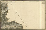
Styrian side of Semmering with stone house and hospital (bottom center), around 1790

Lower Austrian side with Gloggnitz, Schottwien (bottom left), around 1790

Styrian side, northern part, with Adlitzgräben and Preiner Gscheid, around 1873 (bottom right)

Styrian side, southern part, with stone house, hospital and Mürzzuschlag (top right)

Lower Austrian side, railway and road expanded around 1873 (bottom left)


Web links
- Entry on Semmering Pass in the Austria Forum (in the AEIOU Austria Lexicon )
- Hiking information and activities on the Semmering - Wiener-Alpen.at
- Railway at the Semmering Pass: Photo album: SEMMERINGBAHN - Railway, photographed in the "Semmering landscape" (www.eisenbahn-in-oesterreich.at)
Individual evidence
- ^ Michael Hackenberg: Mining in the Semmering area. Archive for deposit research of the Federal Geological Institute. Volume 24. Vienna 2003. ISSN 0253-097X pages 5-97. (PDF; 12.7 MB)
- ↑ Steffan Bruns: Alpine passes - from the mule track to the base tunnel, vol. 4
- ↑ Fritz Frhr. Lochner von Hüttenbach: On the name property of the early Middle Ages in Styria (= magazine of the Historical Association for Styria . Volume 99 ). Böhlau Verlag, Vienna 2008, p. 36 ( historerverein-stmk.at [PDF; 16.9 MB ]).
- ^ History of the Semmering on //www.semmering.or.at/ ( Memento from April 18, 2010 in the Internet Archive )
- ↑ Skiing on Semmering - the magic mountain on the Hirschenkogel. Retrieved August 16, 2019 .
Ahorn • Alpl • Ammer • Annaberg • Arlberg • Ascher • Bieler • Birkfelder • Boding • Brenner • Buchauer • Buchener • Dientner • Dürrholzer • Eibegg • Erb • Eisental • Faschina • Feistritz • Fern • Filzen • Flattnitz • Flexen • Forsthof • Furka • Fuscher • Gaberl • Gaden wide • Gailberg • Gangleit • Geiseben • Gerichtsberg • Gerlos • Geschriebenstein • Goller • Grießen • Griffner • Large Kripp • Grubberg • Grünbacher • Gschuett • Hafner • Hahntenn • neck • Haselrast • Hebalm • stallion • Hengstl • Hiaslegg • Hirschegger • Hochegger • Hochrindl • Hochtannberg • Hochtor • Holzleiten • Iselsberg • Josefsberg • Kaiserauer • Cold Kuchl • Kartitscher • Katsch • Kernhofer • Kerschbaumer • Klachauer • Klamm • Klamml • Small Kripp • Klippitz • Klostertaler • Kraxen • Kreuth • Kreuzberg • Kühtai • Lahn • Lienbach • Loibl • Losen • Luft • Mendling • Michelbühel • Moarigraben • Nassfeld • Neumarkter • Niederalpl • Norberts • Nöring • Obdacher • Oberjoch • Och • Pack • Paulitsch • Perchauer • Pfaffen • Pfarralm • Pielachtaler • Piller • Plöcken • Pogusch • Pölshals • Pötschen • Präbichl • Prebersattel • Preiner • Pretal • Promau • Pyhrn • Radl • Radling • Radstädter • Radstatt • Rams • Raneck • Rechberg • Rieder • Rohrer • Sattler • Saurüssel • Schaida • Schanz • Scharflinger • Schiestel • Schober • Schönfeld • Schwarze Sau • Schwarzenbichl • Seeberg • Seefelder • Semmering • Kleiner Semmering • Sieggraben • Silzer • Soboth • Summer • Staller • Styrian Seeberg • Straßegg • Sölk • Thurn • Timmels • Triebener Tauern • Turracher • Origin • Wechsel • Weinebene • Weißenbacher • Wagrainer • Windische • Wurzen • Zellerrain