Williamtown, New South Wales
| Williamtown | |||||||
|---|---|---|---|---|---|---|---|
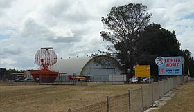
 Airplane Museum at RAAF Base Williamtown |
|||||||
|
|||||||
|
|||||||
|
|||||||
|
|||||||
|
|
|||||||
Williamtown is a rural town of about 800 people in the Australian state of New South Wales . Williamtown is 16 miles north of Newcastle and 15 kilometers east of Raymond Terrace . It is located in the Port Stephens Council Administrative Region (LGA) .
The area east of Williamstown is dominated by RAAF Base Williamtown , a base for the Australian Air Force, and Newcastle Airport . In the west, on the other hand, predominantly rural areas with some larger properties. To the south of Williamtown is Fullerton Cove , a large bay on the Hunter River .
The place is also known for its beaches and the offshore wreck of the Sygna . The Norwegian 50,000 ton freighter ran aground here after a storm in 1974 and broke apart.
Individual evidence
- ↑ Climate statistics for Australian locations (Williamtown RAAF) ( English ) Australian Government - Bureau of Meteorologie . Retrieved December 30, 2010.
- ↑ Australian Bureau of Statistics : Williamtown ( English ) In: 2016 Census QuickStats . June 27, 2017. Retrieved February 8, 2020.
