Yōtei-zan
| Yōtei-zan | ||
|---|---|---|
|
Yōtei-san from the west, from Hirafu , May 2005 |
||
| height | 1898 m TP | |
| location | Southwest of Hokkaidō , Japan | |
| Notch height | 1878 m ↓ | |
| Coordinates | 42 ° 49 ′ 37 " N , 140 ° 48 ′ 22" E | |
|
|
||
| Type | inactive stratovolcano | |
| Last eruption | 1050 BC Chr. | |
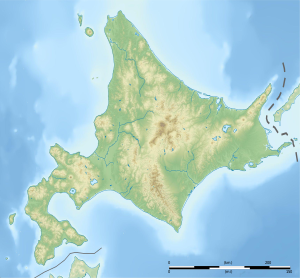
The Yōtei-zan ( Jap. 羊蹄山 , 1,898 m ) is an inactive stratovolcano in the southwestern Japanese island of Hokkaido , within the Shikotsu-Toya National Park area. It is located in Abauta County , just under 5 kilometers northeast of Niseko and 4½ kilometers southeast of Kutchan . Since the shape of the volcano is reminiscent of Japan's most famous volcano, the Fuji , it is also called "Fuji of Hokkaidō" or Ezo-Fuji - "Ezo" is an old name for Hokkaidō. Another name is Shiribeshi-yama ( 後方 羊蹄 山 ), in Ainu it is called Makkari-Nupuri .
The symmetrical volcano is very conspicuous and visible from afar, as it towers over its surroundings by about 1500 meters. The main crater measures 700 meters in diameter, this is broken through on the northwest side by smaller craters. Deep radial gullies cut through the flanks of the volcanic cone.
Using tephrochronological methods, i.e. by examining the pyroclastic layers of deposits, the last eruption was dated to 1050 BC. Dated another 2500 years before there was another eruption. The volcano is composed primarily of basalt andesite and dacite .
The volcano is one of the 100 most famous mountains in Japan.
Ascent
A possible starting point for an ascent of the Yōtei-zan is the Hangetsu Lake in the northwest of the volcano, near Hirafu , between Niseko and Kutchan . In a four-hour hike you can reach the crater rim from there. The three summit craters are called "Father Caldera", "Mother Caldera" and "Little Caldera". You can go around the main crater in a two-kilometer hike.
In winter, if the conditions are good, it is also possible to climb as part of a ski tour , and you can also ski down into the main crater. Since the summit area is exposed to strong winds, the danger of avalanches can be considerable in the upper part of the ascent.
Individual evidence
- ↑ Japan Ultra-Prominences at peaklist.org
- ^ Official topography map of Kokudo Chiriin
- ^ The New Official Guide. Japan Travel Bureau, 1966, p. 1014 ( Google books )
- ↑ a b c Yoteisan in the Global Volcanism Program of the Smithsonian Institution (English)
- ↑ Isa Ducke, Natascha Thoma: Baedeker Travel Guide Japan. Baedeker Verlag, Ostfildern 2014, ISBN 3-8297-1395-9 , p. 521 ( Google books )
- ↑ backcountry.com: Skiing Into a Volcano: Mt. Yotei, Japan.
- ↑ Ryuzo Wakabayashii: Contribution to the investigation of avalanches in the Hokkaidos forest area. University of Hokkaidō, Sapporo 1971 ( online )

