Zamora (Ecuador)
| Zamora | ||
|---|---|---|
|
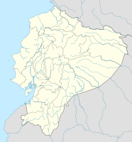
Coordinates: 4 ° 4 ′ S , 78 ° 57 ′ W Zamora on the map of Ecuador
|
||
| Basic data | ||
| Country | Ecuador | |
| province | Zamora chinchipe | |
| City foundation | October 4, 1549 | |
| Residents | 21,791 (2001) | |
| City insignia | ||
| Detailed data | ||
| height | 970 m | |
| Time zone | UTC -5 | |
| City Presidency | Víctor Manuel González Salinas | |
| Website | ||
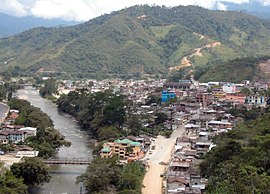
| View over the city | ||
Zamora is the capital of the Zamora Chinchipe province of Ecuador .
geography
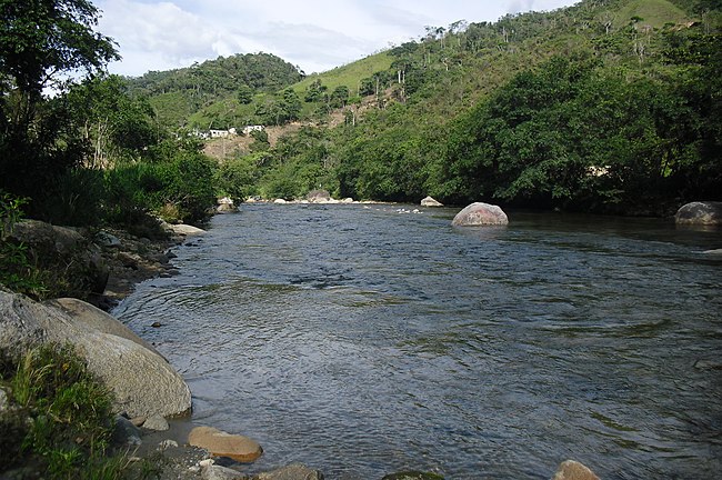
Zamora is located in southern Ecuador, at the point where the Río Bombuscaro and Río Jamboé flow into the Río Zamora . Gold discoveries in the area made Zamora the "mining capital of Ecuador" ( Capital Minera del Ecuador ), but is now also known as the "City of Birds and Waterfalls" ( Ciudad de Aves y Cascadas ).
history
On October 4, 1549, the Spaniards Alonso de Mercadillo, Juan de Salinas Loyola, Hernando de Benavente and Hernando de Barahona founded a settlement. It was baptized with the name Zamora , based on the Spanish city of Zamora , from which Mercadillo came.
Gold discoveries in the east brought about an economic boom for the settlement, but it was abandoned around 1840. A parish was founded in 1868, and parish law was obtained in 1883. Only in the early 1920s did Zamora grow, benefiting from the gold mines of Nambija.
Attractions
To the southeast of the city, on a hill, is the Reloj Gigante , a watch made of precious metal with a dial 30 meters in diameter.
There are several waterfalls around the city:
- Cascada Velo de novia (approx. 20 km west) - 60 meters altitude
- Cascada La Chismosa (in the Podocarpus National Park ) - 2.5 meters high
- Cascada Chorrillos (6 km west) - 10 meters high
- Cascada El destrozo (15 km west) - 40 meters altitude
- Cascada San Ramón (34 km west) - 60 meters altitude
- Cascada El Libano (7 km northwest) - 6 meters high
- Cascada Genairo (6 km northeast) - 120 meters altitude
South of the city is the more than 146,000 hectare Podocarpus National Park, which was established in 1982.
traffic
Zamora is located on the Ecuador 45 state road , which extends from Loja to Nueva Loja in the northeast.
Approx. 8 km northeast of the city is the regional airport Aeropuerto de Cumbaratza (Zamora) .


