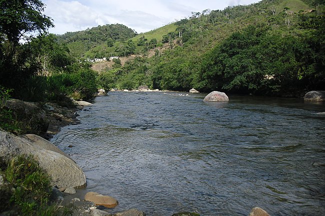
Río Bombuscaro
| Río Bombuscaro | ||
| Data | ||
| location | Province of Zamora Chinchipe in Ecuador | |
| River system | Amazon | |
| Drain over | Río Zamora → Río Santiago → Río Marañón → Amazon → Atlantic Ocean | |
| origin | Laguna San Antonio 4 ° 13 ′ 28 " S , 79 ° 5 ′ 56" W |
|
| Source height | approx. 3280 m | |
| muzzle |
Río Zamora Coordinates: 4 ° 3 ′ 53 ″ S , 78 ° 56 ′ 46 ″ W 4 ° 3 ′ 53 ″ S , 78 ° 56 ′ 46 ″ W. |
|
| Mouth height | approx. 880 m | |
| Height difference | approx. 2400 m | |
| Bottom slope | approx. 80 ‰ | |
| length | 30 km | |
| Catchment area | 224 km² | |
| Small towns | Zamora | |
The Río Bombuscaro is a 30 km long right tributary of the Río Zamora in the province of Zamora Chinchipe in southeast Ecuador .
River course
The Río Bombuscaro rises in the south of the Cordillera Real . The course of the river begins in the Laguna San Antonio mountain lake, which is about 3280 m high . The Río Bombuscaro flows in a predominantly northeastern direction through the mountains and finally reaches the city of Zamora , where it flows into the Río Zamora. With the exception of the bottom four kilometers of the river, the catchment area of the Río Bombuscaro is located within the Podocarpus National Park .
The Río Bombuscaro drains an area of 224 km² on the eastern flank of the Cordillera Real in southeast Ecuador.
Web links
Commons : Río Bombuscaro - collection of images, videos and audio files

