Agona East District: Difference between revisions
Content deleted Content added
mNo edit summary |
Citation bot (talk | contribs) Removed parameters. | Use this bot. Report bugs. | #UCB_CommandLine |
||
| (23 intermediate revisions by 17 users not shown) | |||
| Line 1: | Line 1: | ||
{{Infobox settlement |
|||
{{inuse|date=April 2011}} |
|||
|name = Agona East District |
|||
{| border="1" cellspacing="0" cellpadding="2" width="240" style="margin: 0 0 1em 1em; border: 1px #aaa solid; border-collapse: collapse; font-size: 95%;" align="right" |
|||
|settlement_type = [[Districts of Ghana|District]] |
|||
|align=center colspan=3 bgcolor=#d3d3d3 |<font size=4>'''Agona East District'''</font> |
|||
|native_name = |
|||
| ⚫ | |||
|nickname = |
|||
| ⚫ | |||
|image_skyline = |
|||
| ⚫ | |||
|image_size = |
|||
|- |
|||
|image_caption = |
|||
|align="left" valign="top"|'''District type''' |
|||
|image_flag = |
|||
|colspan=2 valign=top| District Assembly |
|||
|image_seal = |
|||
|- |
|||
| ⚫ | |||
|align="left" valign="top"|'''District Chief Executive''' |
|||
| ⚫ | |||
| ⚫ | |||
|pushpin_map = Ghana |
|||
|- |
|||
|pushpin_label_position = |
|||
|align="left" valign="top"|'''Succeeded''' |
|||
|pushpin_map_caption = Location of Agona East District within [[Central Region, Ghana|Central]] |
|||
|colspan=2 valign=topHon. Dennis Armah Frimpong |
|||
|subdivision_type = Country |
|||
|- |
|||
|subdivision_name = {{flag|Ghana}} |
|||
!align="left" valign="top"|'''Capital''' |
|||
| ⚫ | |||
|colspan=2 valign=top|[[Nsaba]] |
|||
|subdivision_name1 = {{flagicon image|Flag of Central Region (Ghana).gif}} [[Central Region, Ghana|Central]] |
|||
|- |
|||
|subdivision_type2 = Capital |
|||
!align="left" valign="top"|'''Area''' |
|||
|subdivision_name2 = [[Nsaba]] |
|||
|colspan=2 valign=top| - km² |
|||
|leader_title = District Executive |
|||
| ⚫ | |||
|established_title = |
|||
|established_date = |
|||
|area_magnitude = |
|||
|area_total_km2 = 318 |
|||
|area_land_km2 = |
|||
|area_water_km2 = |
|||
|population_as_of = 2021 |
|||
|population_note = |
|||
|population_total = 98,324<ref>[http://www.citypopulation.de/en/ghana/admin/ Ghana: Administrative Division]</ref> |
|||
|population_metro = |
|||
|population_density_km2 = auto |
|||
|timezone = GMT |
|||
|utc_offset = +0 |
|||
|timezone_DST = |
|||
|utc_offset_DST = |
|||
|coordinates = {{coord|5|38|35.88|N|0|45|2.88|W|region:GH|display=inline}} |
|||
|elevation_m = |
|||
|iso_code = GH-CP- |
|||
|blank_name = |
|||
|blank_info = |
|||
|website = |
|||
|footnotes = |
|||
}} |
|||
'''Agona East District''' is one of the twenty-two districts in [[Eastern Region, Ghana|Eastern Region]], [[Ghana]].<ref>[http://ghanadistricts.gov.gh/home/?_=27&sa=3399 District: Agona East District] {{webarchive|url=https://web.archive.org/web/20120323051508/http://ghanadistricts.gov.gh/home/?_=27&sa=3399 |date=2012-03-23 }}</ref><ref>{{Cite web |last=Yarboi-Tetteh |first=David O. |date=31 October 2019 |title=Ghana: Floods Cause Havoc in 8 Districts in Central Region ... Ucc Suspends Lectures |url=https://allafrica.com/stories/201910310368.html |access-date=26 May 2022 |website=allAfrica}}</ref> Originally it was formerly part of the then-larger '''[[Agona District]]''' in 1988, until the eastern part of the district was split off to create '''Agona East District''' on 29 February 2008; thus the remaining part has been renamed as '''[[Agona West District]]''', which was also elevated to municipal district assembly status on that same year to become '''[[Agona West Municipal District]]'''. The district assembly is located in the northeast part of Central Region and has [[Nsaba]] as its capital town. |
|||
==List of settlements== |
|||
{| class="wikitable sortable" style="text-align: centre;" |
|||
|- bgcolor=#EEEEEE |
|||
|align=center colspan=4|'''[[Human settlement|Settlements]] of Upper Denkyira East Municipal Assembly''' |
|||
| ⚫ | |||
!class="unsortable"| No. |
|||
!class="unsortable"| [[Human settlement|Settlement]] |
|||
!class="unsortable"| Population |
|||
!class="unsortable"| Population year |
|||
|- |
|- |
||
|align= |
|align=center| '''1''' |
||
|align= |
|align=center| '''[[Nsaba]]''' |
||
|align=center| |
|||
|align=center| |
|||
|- |
|- |
||
!align="left" valign="top"|[[ISO 3166]] |
|||
|colspan=2 valign=top| GH-WP-SA |
|||
|} |
|} |
||
The '''Agona East District'''<ref>http://ghanadistricts.gov.gh/home/?_=27&sa=3399</ref> is a [[Districts of Ghana|district of Ghana]] in the [[Western Region (Ghana)|Western Region]] of [[Ghana]]. The district is among the new districts and municipalities created in [[2008]] by the then President, [[John Kufuor]]. It was inaugurated on the 29th of [[February]] 2008. |
|||
==Sources== |
==Sources== |
||
* {{statoids|id=ygh|title= |
* {{statoids|id=ygh|title=Agona East District}} |
||
* [http://www.ghanadistricts.com/index.asp |
* [https://web.archive.org/web/20051220143612/http://www.ghanadistricts.com/index.asp District: Agona East District] |
||
==References== |
==References== |
||
{{reflist}} |
{{reflist}} |
||
{{coord missing|Ghana}} |
|||
{{Central Region, Ghana}} |
{{Central Region, Ghana}} |
||
{{coord|5|38|35.88|N|0|45|2.88|W|region:GH|display=title}} |
|||
[[Category:Central Region (Ghana)]] |
|||
[[Category:Districts of the Central Region (Ghana)]] |
|||
| ⚫ | |||
| ⚫ | |||
| ⚫ | |||
Latest revision as of 13:26, 27 September 2023
Agona East District | |
|---|---|
 Districts of Central Region | |
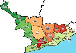
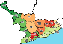
Location of Agona East District within Central | |
| Coordinates: 5°38′35.88″N 0°45′2.88″W / 5.6433000°N 0.7508000°W | |
| Country | |
| Region | |
| Capital | Nsaba |
| Government | |
| • District Executive | Martin Luther Obeng |
| Area | |
| • Total | 318 km2 (123 sq mi) |
| Population (2021) | |
| • Total | 98,324[1] |
| Time zone | UTC+0 (GMT) |
| ISO 3166 code | GH-CP- |
Agona East District is one of the twenty-two districts in Eastern Region, Ghana.[2][3] Originally it was formerly part of the then-larger Agona District in 1988, until the eastern part of the district was split off to create Agona East District on 29 February 2008; thus the remaining part has been renamed as Agona West District, which was also elevated to municipal district assembly status on that same year to become Agona West Municipal District. The district assembly is located in the northeast part of Central Region and has Nsaba as its capital town.
List of settlements[edit]
| Settlements of Upper Denkyira East Municipal Assembly | |||
| No. | Settlement | Population | Population year |
|---|---|---|---|
| 1 | Nsaba | ||
Sources[edit]
References[edit]
- ^ Ghana: Administrative Division
- ^ District: Agona East District Archived 2012-03-23 at the Wayback Machine
- ^ Yarboi-Tetteh, David O. (31 October 2019). "Ghana: Floods Cause Havoc in 8 Districts in Central Region ... Ucc Suspends Lectures". allAfrica. Retrieved 26 May 2022.


