
BR-153 (Brazil highway)
 | |
|---|---|
 | |
| Route information | |
| Length | 2,234.14 mi[1] (3,595.50 km) |
| Existed | 1951 (Rio-São Paulo) 1948 (Rio-Fortaleza) 1967-1977 (divided highways of Rodovia Presidente Dutra and Rodovia Régis Bittencourt)–present |
| Major junctions | |
| North end | São Domingos do Araguaia, Pará |
| TO-222 in Araguaína, TO TO-080 in Paraíso do Tocantins, TO BR-060 in Goiânia, GO BR-456 in São José do Rio Preto, SP BR-277 in Irati, PR BR-285 in Passo Fundo, RS | |
| South end | Aceguá, Rio Grande do Sul / Brazil-Uruguay border |
| Location | |
| Country | Brazil |
| Highway system | |
The BR-153 is a major federal highway of Brazil, officially named as Transbrasiliana Highway, and also as Belém-Brasília Highway in the stretch located between the cities of Wanderlândia, in Tocantins, and Anápolis, in Goiás.
It crosses Brazil in the North-South direction, starting in São Domingos do Araguaia, state of Pará and ending in Aceguá, in the state of Rio Grande do Sul on the Brazil/Uruguay border. The highway, highly variable in quality and traffic, cuts through the states of Pará, Tocantins, Goiás, Minas Gerais, São Paulo, Paraná, Santa Catarina and Rio Grande do Sul.
Gallery
-
 Stretch of BR-153 in Fortaleza do Tabocão, TO.
 -

-

-

-

-
-
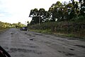
 Segment of BR-153 in rural Cachoeira do Sul, RS.


See also
External links
| Radial highways (originating from Brasília) | |
|---|---|
| North-south highways | |
| East-west highways | |
| Diagonal highways | |
| Link highways |
|
- ^ "BR-153 length between major junctions". Ministério dos Transportes do Brasil. Retrieved August 15, 2014.