Panqueba: Difference between revisions
Content deleted Content added
re-categorisation per CFD, Replaced: Category:Municipalities of Boyacá → Category:Municipalities of Boyacá [[Category:Cities, towns and villa using AWB |
m Removing from Category:Populated places in the Boyacá Department in subcat using Cat-a-lot |
||
| (27 intermediate revisions by 24 users not shown) | |||
| Line 1: | Line 1: | ||
{{Infobox settlement |
|||
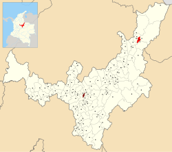
[[Image:MunsBoyaca Panqueba.png|thumb|right|250px|Location of the town and municipality of '''Panqueba''' in [[Boyacá Department]].]] |
|||
<!-- See Template:Infobox settlement for additional fields and descriptions --> |
|||
|name = Panqueba |
|||
|native_name = |
|||
|nickname = |
|||
|motto = |
|||
|settlement_type = [[Municipalities of Colombia|Municipality]] and town |
|||
|image_skyline = Panqueba Parque.JPG |
|||
|imagesize = |
|||
|image_caption = |
|||
|image_flag = Flag of Panqueba (Boyacá).svg |
|||
|image_seal = |
|||
|image_map = Colombia - Boyaca - Panqueba.svg |
|||
|mapsize = 250px |
|||
|map_caption = Location of the municipality and town of Panqueba in the Boyacá Department of Colombia. |
|||
|pushpin_map = |
|||
|pushpin_mapsize =300 |
|||
|pushpin_map_caption =Location in Colombia |
|||
|subdivision_type = Country |
|||
|subdivision_name = {{flag|Colombia}} |
|||
|subdivision_type1 =[[Departments of Colombia|Department]] |
|||
|subdivision_name1 = [[Boyacá Department]] |
|||
|subdivision_type2 = Province |
|||
|subdivision_name2 = [[Gutiérrez Province]] |
|||
|leader_title = Mayor |
|||
|leader_name = Jorge Mario Ibáñez Arango<br>{{Small|(2020-2023)}} |
|||
|established_title = |
|||
|established_date = |
|||
|area_magnitude = |
|||
|area_total_km2 = |
|||
|area_total_sq_mi = |
|||
|area_land_km2 = |
|||
|area_land_sq_mi = |
|||
|area_water_km2 = |
|||
|area_water_sq_mi = |
|||
|area_water_percent = |
|||
|area_urban_km2 = |
|||
|area_urban_sq_mi = |
|||
|area_metro_km2 = |
|||
|area_metro_sq_mi = |
|||
|population_as_of = |
|||
|population_note = |
|||
|population_total = |
|||
|population_density_km2 = |
|||
|population_density_sq_mi = |
|||
|population_metro = |
|||
|population_density_metro_km2 = |
|||
|population_density_metro_sq_mi = |
|||
|population_urban = |
|||
|coordinates = |
|||
|timezone = Colombia Standard Time |
|||
|utc_offset = -5 |
|||
|timezone_DST = |
|||
|utc_offset_DST = |
|||
|elevation_m = |
|||
|elevation_ft = |
|||
|website = |
|||
|footnotes = |
|||
}} |
|||
'''Panqueba''' is a town and municipality in the [[ |
'''Panqueba''' is a town and municipality in the [[Colombia]]n [[Departments of Colombia|Department]] of [[Boyacá Department|Boyacá]], part of the subregion of the [[Gutiérrez Province]]. |
||
{{Municipalities boyaca department}} |
{{Municipalities boyaca department}} |
||
| Line 7: | Line 65: | ||
{{coord|6|26|N|72|28|W|display=title|region:CO_type:city_source:GNS-enwiki}} |
{{coord|6|26|N|72|28|W|display=title|region:CO_type:city_source:GNS-enwiki}} |
||
[[Category:Municipalities of Boyacá]] |
[[Category:Municipalities of Boyacá Department]] |
||
| ⚫ | |||
[[Category:Cities, towns and villages in the Boyacá Department]] |
|||
| ⚫ | |||
Latest revision as of 14:55, 24 August 2020
Panqueba | |
|---|---|
Municipality and town | |
 | |
 Location of the municipality and town of Panqueba in the Boyacá Department of Colombia. | |
| Country | |
| Department | Boyacá Department |
| Province | Gutiérrez Province |
| Government | |
| • Mayor | Jorge Mario Ibáñez Arango (2020-2023) |
| Time zone | UTC-5 (Colombia Standard Time) |
Panqueba is a town and municipality in the Colombian Department of Boyacá, part of the subregion of the Gutiérrez Province.

