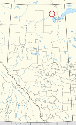
Peace Point 222
Peace Point 222 | |
|---|---|
| Peace Point Indian Reserve No. 222 | |
 Location in Alberta | |
| First Nation | Mikisew Cree |
| Treaty | 8 |
| Country | Canada |
| Province | Alberta |
| Improvement district | 24 |
| Area | |
| • Total | 518 ha (1,280 acres) |
Peace Point 222 is an Indian reserve of the Mikisew Cree First Nation in Alberta, located within Improvement District No. 24 (Wood Buffalo National Park).[3][1]
References[edit]
- ^ a b "Reserve/Settlement/Village Detail". Crown–Indigenous Relations and Northern Affairs Canada. Government of Canada. 14 November 2008. Retrieved August 12, 2019.
- ^ "Census Profile, 2016 Census". Statistics Canada. February 8, 2017. Retrieved 2019-08-10.
- ^ Government of Alberta (May 25, 2019). Municipal Boundaries (Map). AltaLIS.
59°08′14″N 112°25′53″W / 59.1371°N 112.4314°W
