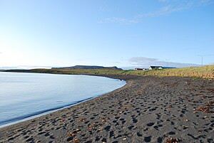
Öxarfjörður
| Öxarfjörður | ||
|---|---|---|
|
Beach at Öxarfjörður near Kópasker |
||
| Waters | Greenland Sea | |
| Land mass | Iceland | |
| Geographical location | 66 ° 12 ′ N , 16 ° 30 ′ W | |
|
|
||
| width | 28 km | |
| depth | 11 km | |
| Tributaries | Bakkahlaup, Jökulsá á Fjöllum , Brunná | |
|
Naustárfoss waterfall at Öxarfjörður, 10 km south of Kópasker, Tjörnes in the background |
||
The Öxarfjörður is a wide bay in the northeast of Iceland .
The name translates as Axtfjord , although it does not have the typical shape of a fjord. The residents of the district discussed, among other things. a. about whether the fjord should actually be called Axarfjörður . In the end it was decided against it. The bay is west of the Melrakkaslétta peninsula and east of the Tjörnes peninsula . Only here does the municipality of Tjörnes border the bay, which is otherwise enclosed by the municipality of Norðurþing . The Öxarfjörður is almost 30 km wide and extends from the steep coast of the Tjörnes peninsula over the flat plains of Kelduhverfi to the hills of Melrakkaslétta.
The Norðausturvegur runs along the west and east banks ![]() . It circles the mouth of the Jökulsá á Fjöllum on the south bank at a greater distance. On the east bank further north runs the Sléttuvegur
. It circles the mouth of the Jökulsá á Fjöllum on the south bank at a greater distance. On the east bank further north runs the Sléttuvegur ![]() , the former course of the Norðausturvegur.
, the former course of the Norðausturvegur.
After Landnámabók , the first settlers in the area were Vestmaður, his brother Vémundur and Einar Þorgeirsson. After arriving in Iceland, they sailed to Melrakkaslétta . There they struck an ax in the mountain Reistargnúpur and named the nearby fjord Öxarfjörður, to the west of it they placed an eagle on a rock and named it Arnarþúfa ; finally they put up a cross in a third place and named the place Krossás .
Overall, the area is not densely populated. You will mainly find scattered farms here. The only larger settlement is the place Kópasker with 137 inhabitants (2009). It is located on the east bank of Öxarfjörður.
The Öxarfjörður is located in a geologically very active area, in which the northern active volcanic and rift zone intersects with a fracture zone and is shifted to the west towards the Kolbeinseyjarrücken. The fracture zone is called the Tjörnes fracture zone and is approx. 70 km wide and approx. 120 km long. It contains five active volcanic systems, including the Askja and Krafla . The plate tectonics can during individual periods of disturbance earthquake a thickness between 6 and 7 of the Richter scale produce.
At least three active volcanic systems protrude into the fjord with their northern crevices: Þeistareykir , Krafla and Fremri-Námur
In the Öxarfjörður flows the Jökulsá á Fjöllum, one of the most water-rich glacier rivers in Iceland, which comes from the south of Vatnajökull and branches into several branches before the confluence in Kelduhverfi , the most important of which are Bakkahlaup (in the west) and Brunná in the east .
Web links
- Helga Kristmannsdóttir ea: Groundwater geochemistry in the Öxarfjördur area, NE Iceland. International Geological congress, Oslo, 2008.
- Helga Kristmannsdóttir, ea: Evolution and origin of geothermal waters in Öxarfjörður, Iceland . (PDF file, English)
- Lúdvíg Georgsson, ea: Resistivity methods DC and TEM with examples and comparison from the Reykjanes peninsula and Öxarfjördur, Iceland. El Salvador, 2009. (PDF file; 2.0 MB) (English)
- To the natural treasures of the district (Icelandic) (PDF; 2.7 MB)
- http://www.nat.is/travelguide/ahugav_st_oxarf.htm
Individual evidence
- ↑ cf. HU Schmid. Icelandic-German dictionary . Hamburg, Buske, 2002, p. 12
- ↑ cf. Arnastofnun ( Memento of March 31, 2010 in the Internet Archive ) Accessed: April 1, 2011
- ^ Own translation from Landnámabók (74. kafli); Icelandic original text: “Þeir settu öxi í Reistargnúp og kölluðu því Öxarfjörð; þeir settu örn upp fyrir vestan og kölluðu þar Arnarþúfu; en í þriðja stað settu þeir kross; þar nefndu þeir Krossás. “ http://snerpa.is/net/snorri/landnama.htm Accessed April 1, 2011
- ↑ cf. z. B. Helga Kristmannsdóttir ea: Groundwater geochemistry in the Öxarfjördur area, NE Iceland. International Geological congress, Oslo, 2008., p. 1 Accessed April 9, 2011
- ↑ cf. Thor Thordarson, Armann Hoskuldsson: Classic Geology in Europe 3. Iceland. Harpenden 2002, p. 136
- ↑ Ari Trausti Guðmundsson: Living Earth. Facets of the geology of Iceland. Reykjavík (Mál og Menning) 2007, p. 125
- ↑ cf. Íslandshandbókin. 1. bindi. 1989, p. 518ff.


