Şərur (city)
| Şərur | ||

|
||
| State : |
|
|
| Rayon : | Şərur | |
| Coordinates : | 39 ° 33 ' N , 44 ° 58' E | |
| Height : | 810 m | |
| Residents : | 7,100 (2014) | |
| Time zone : | AZT ( UTC + 4 ) | |
| Telephone code : | (+994) 36542 | |
| Postal code : | AZ6800 | |
| License plate : | 68 | |
| Community type: | City (şəhər) | |
|
|
||
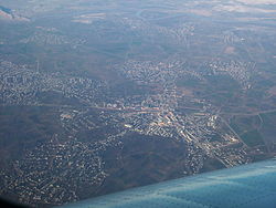
Sharur district is a city in Azerbaijan and capital of the district sharur district in the Nakhchivan Autonomous Republic . Şərur had about 7,100 inhabitants in 2014.
history
The place developed with the construction of the railway line from Naxçıvan to Armenia at the beginning of the 20th century. It took over from the nearby town of Yengijar the importance of being the center of the region. During this time, the place became the administrative seat of a Ujesds of the Yerevan governorate of the Russian Empire under the name Basch-Noraschen ( Armenian Նորաշեն , Noraschen for "New Village"). Despite the Armenian name, most of the residents were Azerbaijanis during this period (almost 60% in the 1897 census).
The place name was later shortened to Noraschen . On November 11, 1948, it received the status of an urban-type settlement and on May 26, 1964 the name Ilyichovsk ( Russian Ильичёвск ; Azerbaijani İliç ) after the patronymic of Vladimir Ilyich Lenin . In 1981 city rights were granted. Since 1991 the city has had its current name after the old name of the surrounding area.
Culture
There is a recently built mosque and a museum in the city. There are also two parks and a cinema.
traffic
Şərur has a train station on the Yerevan – Dscholfa railway line, which opened in 1908 . The railway traffic in Nakhichevan has been discontinued because the connection to the rest of the Azerbaijani railway network only exists via routes running through Armenia .
Buses run.
Twin cities
Web links
Individual evidence
- ↑ Population by sex, economic and administrative regions, urban settlements of the Republic of Azerbaijan at the beginning of the 2014 ( Memento from July 16, 2014 in the Internet Archive ) on the website of the Azərbaycan Respublikasının Dövlət Statistika Komitəsi (State Statistics Committee of the Republic of Azerbaijan)
- ↑ a b c azerb.com about city and rayon
- ^ SA Melʹnikov, Č. G. Ibragimov: Azerbajdžanskaja SSR. Administrativno-territorial ʹ noe delenie na 1 janvarja 1977 goda . 4th edition. Baku 1979 (Russian, online [PDF; 1.5 MB ]).
