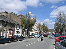
A494 road
| A494 road in the UK | |

|
|
| |
|
| map | |
| Basic data | |
| Operator: | |
| Start of the street: | Dolgellau |
| End of street: | M56 motorway |
| Overall length: | 99.6 km (61.9 mi ) |
| The A494 near Queensferry (photo 2012) | |
The A494 road ( English for road A494 ) is a consistently designated primary route trunk road in Wales and England. It is also known as Dolgellau to South of Birkenhead Trunk Road . The road branches off the A470 road at the Dolgellau bypass and runs along the Afon Wnion on the eastern border of the Snowdonia National Park upstream to Llanuwchllyn . It then follows the west bank of Llyn Tegid (English: Bala Lake) and passes Bala ( Welsh Y Bala ). There the A4212 road branches off to the west to Trawsfynydd . After a further 13 km, the A494 meets the A5 road , with which it runs parallel for around 3 km, but then branches off to the north again and leads through Gwyddelwern and further along the Afon Clwyd downstream to Ruthin ( Rhuthun in Welsh ). There it generally turns to the northwest, crosses the Clwdian Range and leads northwest to Buckley ( Welsh Bwcle ) past. It runs a short distance together with the A55 road and continues, now with six lanes and level crossing free, via Queensferry until it meets and ends at the M56 motorway .
The northernmost section of the A494 forms part of the European route 22 .


