Abercrombie River
| Abercrombie River | ||
|
Abercrombie River |
||
| Data | ||
| location | New South Wales , Australia | |
| River system | Murray River | |
| Drain over | Lachlan River → Murrumbidgee River → Murray River → Indian Ocean | |
| source | Mount Werong ( Kanangra Boyd National Park ) 34 ° 5 ′ 59 ″ S , 149 ° 56 ′ 40 ″ E |
|
| Source height | 1130 m | |
| muzzle |
Lake Wyangala ( Lachlan River ) Coordinates: 33 ° 54 ′ 23 " S , 149 ° 3 ′ 15" E 33 ° 54 ′ 23 " S , 149 ° 3 ′ 15" E |
|
| Mouth height | 375 m | |
| Height difference | 755 m | |
| Bottom slope | 4.1 ‰ | |
| length | 186 km | |
| Left tributaries | Burra Burra Creek, Bolong River , Tuena Creek, Meglo Creek | |
| Right tributaries | Isabella River , Copperhannie Creek, Piesleys Creek | |
| Reservoirs flowed through | Lake Wyangala | |
| Small towns | Abercrombie | |
|
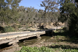
Bridge over the river on the course of the Goulburn to Oberon road |
||
The Abercrombie River is a river in the middle of the Australian state of New South Wales .
course
It rises on the southern slopes of Mount Werong in the southwest of Kanangra Boyd National Park , flows west, flows into Lake Wyangala at Cowra and thus into the Lachlan River .
The 130 km long river flows through private land as well as the Abercrombie River National Park and provides habitat for the platypus and the golden-bellied swimming rat . The road from Goulburn to Oberon crosses the river in the narrow Abercrombie Gorge .
history
The first inhabitants of the country on the river banks were the Aborigines of the Wiradjuri - or Gundungara tribe, who probably used the Abercrombie River as a trade route.
The first European to discover the watercourse was Charles Throsby on May 5, 1819 , when he went on an expedition from Sydney to the western center of New South Wales. Gold was discovered in and around the river in 1851 and led to a small gold rush, which was hampered by the inaccessibility of the land and the sometimes deep river course. Early prospectors found up to 3 ounces of gold per day on the river and by 1862 there were already 40-50 prospectors groups on Milburne Creek , a nearby, small tributary of the Lachlan River.
See also
Web links
Individual evidence
- ↑ a b c Map of Abercrombie River, NSW . Bonzle.com
- ^ A b Geographical Names Register: Abercrombie River . Geographical Names Board of New South Wales. (July 2009) ( Memento from June 5, 2011 in the Internet Archive )
- ↑ Abercrombie River National Park . NSW National Parks and Wildlife Service. (July 2009)
- ↑ Abercrombie River National Park: Culture and History . NSW Department of Environment an Climate Change (2009)
- ↑ THE WENTWORTH DIGGINGS ( Memento from July 19, 2012 in the web archive archive.today )
- ↑ THE GOLD FIELDS ( Memento from July 15, 2012 in the web archive archive.today )
- ↑ NEW SOUTH WALES ( Memento from July 11, 2012 in the web archive archive.today )

