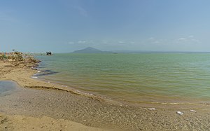
Afrera lake
| Afrera lake | ||
|---|---|---|

|
||
| Geographical location | Afar Region ( Ethiopia ) | |
| Drain | drainless | |
| Islands | Franchetti Island | |
| Data | ||
| Coordinates | 13 ° 16 ' N , 40 ° 54' E | |
|
|
||
| Depth below sea level | 102 m below sea level | |
| surface | 100 km² | |
| length | 30 km | |
| width | 7 km | |
|
particularities |
||
The Afrera Lake ( Afrera YeCh'ew Hayk ' ) is a salt lake of 100 km² in northern Ethiopia . It is next to the lake karum and Bakilisee one of the three salt lakes in the Afar region . It is strongly constricted in the middle, here is the Borawli volcano on the east side , and has an island called Afrera Deset in its southern half.
The lake is located in the hot and extremely dry Danakil Depression and is also known under the name of Lago Giulietti . The Italian Africa explorer Raimondo Franchetti , who reached him in 1929 and was the first to report on him, named him after his compatriot and geographer Giuseppe Maria Giulietti, who had been killed by members of the Afar in a village near the lake.
Rock salt ( halite ) has been mined at the lake for centuries . An Ethiopian company has established the existence of 290 million tons of salt on Lake Afrera alone. Some local companies are currently pumping brine into man-made ponds. There, the dry salt is broken into blocks and transported to the Ethiopian highlands. On the first part of the route, this is mostly done with camel caravans. For centuries, the salt bars extracted from the Danakil Lakes were both food and salt money ( amole ) .

