Alba (ditch)
|
Alba Třebechovický náhon, Vantroka |
||
|
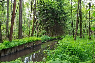
The Alba in the Týnišťské Poorličí natural monument |
||
| Data | ||
| Water code | CZ : 1-02-03-053 | |
| location | Czech Republic | |
| River system | Elbe | |
| Drain over | Dědina → Adler → Elbe → North Sea | |
| source |
Bělá near Častolovice 50 ° 7 ′ 39 ″ N , 16 ° 10 ′ 58 ″ E |
|
| Source height | 265 m nm | |
| muzzle |
Dědina bei Třebechovice pod Orebem Coordinates: 50 ° 12 ′ 8 ″ N , 15 ° 59 ′ 51 ″ E 50 ° 12 ′ 8 ″ N , 15 ° 59 ′ 51 ″ E |
|
| Mouth height | 240 m nm | |
| Height difference | 25 m | |
| Bottom slope | 1.3 ‰ | |
| length | 19 km | |
| Catchment area | 66.2 km² | |
| Navigable | No | |

The Alba , also Třebechovický náhon or Vantroka, is a 19 km long ditch in the Czech Republic . It is derived from the Bělá ( Alba ) at Častolovice , runs parallel to the Wild Eagle or Eagle and flows into the Dědina at Třebechovice pod Orebem . Its width is between one and a half and three meters.
course
The moat begins on the southern outskirts of Častolovice below the railway bridge on the Bělá weir. It runs in a westerly direction via Čestice , Podchlumí, Lípa nad Orlicí , Dlouhá Louka, Týniště nad Orlicí , Petrovice, Dvůr and Bědovice to Třebechovice pod Orebem.
The average flow rate of the Alba is 0.35 m³ / s, which corresponds to 11 million m³ annually. The capacity of the trench is limited to 0.6 m³ / s.
Below the confluence of the largest tributary, the Olešnický potok , in Čestice there is a water divider set to a maximum flow of 0.45 m³ / s. When the water level in the ditch is low, more water is discharged from the Olešnický potok; the rest of the water is drained on the left via the Olešnický potok to the Wilder Adler.
At the water divider near Týniště nad Orlicí, most of the water from the Alba is drained via a relief ditch ( Odlehčovač náhonu Alba ) through the town to the Adler.
Between Týniště nad Orlicí and Třebechovice pod Orebem, water is released into numerous small ditches on the left, which used to feed the pond system. As a result, the amount of water from the Alba at its confluence with the Dědina is low.
At Petrovice the Alba is bridged by the Choceň – Meziměstí railway line.
Tributaries
- Konopáč (r), in Častolovice
- Olešnický potok (r), in Čestice
- Houkvický potok (r), near Petrovice
history
The Alba was built as a mill moat in the 14th century . At that time it probably flowed into the Adler near Týniště nad Orlicí. The lower mill in the center of the town of Týniště at the current relief moat has been documented since the end of the 14th century; it was expanded in 1911 to become a municipal power station. At the end of the 15th century, Wilhelm II. Von Pernstein an der Adler had a system of fish ponds built and the Alba expanded to become the water supply channel for the ponds.
With the exception of a few small ponds, all fish ponds have now been drained.
Individual evidence
- ↑ mapy.cz
- ↑ Povodí Labe - Water balance 2007
- ↑ Čestice - Povodňový plan
- ↑ Michaela Hakenová: Diplomová práce - Historické změny spojené Orlice za posledních 200 let a hodnocení současného stavu vodního toku p. 32
- ↑ Povodí Labe - Water balance 2007
