Almersberg (Palatinate)
| Almersberg | ||
|---|---|---|
|
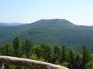
Almersberg; View from the cherry rock |
||
| height | 564.1 m above sea level NHN | |
| location | District of Südliche Weinstrasse , Rhineland-Palatinate ( Germany ) | |
| Mountains | Palatinate Forest | |
| Coordinates | 49 ° 14 '53 " N , 7 ° 55' 12" E | |
|
|
||
The Almersberg is 564.1 m above sea level. NHN high mountain northwest of Annweiler am Trifels in the central Palatinate Forest .
Geographical location
The Almersberg is located north of the municipality of Rinnthal and west of Eusserthal on the area of an exclave of the town of Annweiler am Trifels in the southern Weinstrasse district in Rhineland-Palatinate .
Connection
A hiking trail marked with a red dot leads over the Almersberg . It leads around the entire plateau and crosses itself. In a southerly direction it leads to Rinnthal and in the east to Ramberg . Bundesstrasse 48 also runs one kilometer west of Almersberg .
Web links
Commons : Almersberg - Collection of Images
Individual evidence
- ↑ a b Map service of the landscape information system of the Rhineland-Palatinate Nature Conservation Administration (LANIS map) ( notes ) Scale 1: 3,000


