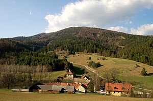
Almesbrunnberg
| Almesbrunnberg | ||
|---|---|---|
|
Almesbrunnberg, south side |
||
| height | 1079 m above sea level A. | |
| location | Lower Austria | |
| Mountains | Gutenstein Alps | |
| Dominance | 3.27 km → Traflberg | |
| Notch height | 190 m ↓ north of Kalter Berg | |
| Coordinates | 47 ° 56 '7 " N , 15 ° 55' 14" E | |
|
|
||
The Almesbrunnberg is 1079 m above sea level. A. high mountain in the Gutenstein Alps in the municipality of Muggendorf in Lower Austria . The highest point is completely surrounded by forest. A large clearing just south and west of it, however, offers unobstructed views of the Kalkhochalpen from Schneeberg to Hochkar .
From the Jagasitz inn ( 715 m ) or the Berg farmstead , marked hiking trails lead up to around 300 meters to the Almesbrunnberg. The last piece must then be covered without a path and unmarked.
From Furth an der Triesting to the east, an insured path leads through the Steinwandklamm with the through cave of the Türkenloch to the saddle with the Jagasitz inn, which can also be reached on a public road from Muggendorf to the south.
literature
- Fritz Peterka: The local mountains of Vienna . Verlag Anton Schroll & Co., Vienna, 1985. ISBN 978-3703106101
- Winter hike on the Almesbrunnberg (photo gallery) , accessed on February 12, 2011

