
Alva (Scotland)
|
Alva Scottish Gaelic Allmhagh Beag |
|||
|---|---|---|---|
 |
|||
| Coordinates | 56 ° 9 ′ N , 3 ° 48 ′ W | ||
|
|||
| Residents | 4773 2011 census | ||
| administration | |||
| Post town | ALVA | ||
| ZIP code section | FK12 | ||
| prefix | 01259 | ||
| Part of the country | Scotland | ||
| Council area | Clackmannanshire | ||
| British Parliament | Ochil and South Perthshire | ||
| Scottish Parliament | Clackmannanshire and Dunblane | ||

Alva ( Scottish Gaelic Allmhagh Beag or Ailbheach ( rocky )) is a town in the Scottish Council Area of Clackmannanshire . Alva is about eight kilometers northeast of Stirling and three kilometers north of Alloa at the foot of the Ochil Hills and is one of the Hillfoots Villages . The Forth flows a few kilometers, the Devon a few hundred meters south. Alva is connected to the road network by the A91 . In 2011 Alva had 4773 inhabitants.
history
Historically, textile production was an important industry in Alva and contributed significantly to its development. The companies used the numerous mountain streams along the slopes of the Ochils to generate energy. Tweed , tartans and knitwear have been produced there since the 16th century . In the 1880s there were eight spinning mills in Alva.

Alva

The Alva Burn in front of Alva
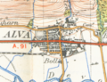
Alva in 1945


Web links
Individual evidence
- ^ List of Gaelic expressions
- ↑ a b Alva. In: Francis H. Groome: Ordnance Gazetteer of Scotland: A Survey of Scottish Topography, Statistical, Biographical and Historical. Volume 1: (A - Coru). Thomas C. Jack, Grange Publishing Works, Edinburgh et al. 1882, p. 46.
- ↑ 2011 census
- ↑ Josephine Buchanan: Scotland (= Insight Guide. ). 4th edition, updated. APA Publications, Singapore 2003, ISBN 981-234-950-2 , p. 264.
- ^ Alva Clackmannanshire. In: David Munro, Bruce Gittings: Scotland. An Encyclopedia of Places & Landscapes. Collins et al., Glasgow 2006, ISBN 0-00-472466-6 .