Ambergris Caye
| Ambergris Caye | ||
|---|---|---|
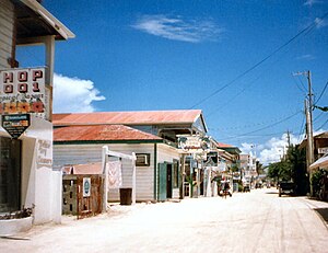
| San Pedro on Ambergris Caye | ||
| Waters | Caribbean Sea | |
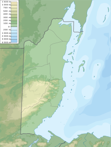
| Geographical location | 18 ° 1 ′ N , 87 ° 56 ′ W | |
|
|
||
| length | 40 km | |
| width | 1.6 km | |
| surface | 64 km² | |
| Residents | 13,000 203 inhabitants / km² |
|
| main place | San Pedro | |
Ambergris Caye is the largest of over 200 islands off the coast of Belize in Central America .
The island is approximately 34 kilometers long and is 56 kilometers northeast of Belize City in the Caribbean Sea . The area covers 64 km². The main town is San Pedro with around 12,900 inhabitants (as of 2009) who live almost exclusively from tourism. Politically, Ambergris Caye belongs to the Belize District Province . The island takes its name from the ambergris (Ambra grisea, in English amber or amber), which was washed up there in large quantities.
The first inhabitants of Ambergris Caye were Maya - the oldest traces go back to the late pre-classical period . It was not until the 17th century that the first Europeans came to the island - mainly pirates.
The Belize Barrier Reef runs next to Ambergris Caye , which is why Ambergris Caye is the ideal starting point for tours for divers and snorkelers. The island is now the largest tourist center in Belize.
Individual evidence
- ↑ Ambergris Cay, Belize - Cruise Away ( April 6, 2012 memento in the Internet Archive )
Web links
- AmbergrisCaye.com - in English

