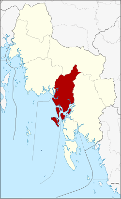
Amphoe Nuea Khlong
|
Nuea Khlong เหนือ คลอง |
|
|---|---|
| Province: | Krabi |
| Surface: | 414.8 km² |
| Residents: | 60,071 (2012) |
| Population density : | 132.1 U / km² |
| ZIP : | 81130 |
| Geocode : | 8108 |
| map | |

|
|
Nuea Khlong District ( Thai : อำเภอ เหนือ คลอง ) is a district ( Amphoe - administrative district) of the province of Krabi . Krabi Province is located in the southern region of Thailand .
geography
Neighboring districts are - clockwise from the northwest - the Amphoe Mueang Krabi , Khao Phanom , Khlong Thom and Ko Lanta in Krabi Province. To the west is the Andaman Sea .
history
The subdistrict ( King Amphoe ) Nuea Khlong was established on March 13, 1992 by separating eight tambon from Amphoe Mueang Krabi . On December 5, 1996, the district received its full amphoe status.
traffic
Krabi International Airport is located in Amphoe Nuea Khlong and connects the province with the other parts of the country and with neighboring countries.
administration
Provincial Administration
Amphoe Nuea Khlong is divided into eight communities ( Tambon ) , which in turn are divided into 56 village communities ( Muban ) .
|
Local administration
Nuea Khlong ( เทศบาล ตำบล เหนือ คลอง ) is a small town ( Thesaban Tambon ) in the district, it consists of parts of the Tambon Nuea Khlong.
There are also eight “tambon administration organizations” (TAO, องค์การ บริหาร ส่วน ตำบล ) for the tambon or the parts of tambon in the county that do not belong to any town.
Individual evidence
- ↑ ประกาศ กระทรวง มหาดไทย เรื่อง แบ่ง เขต ท้องที่ อำเภอ เมือง กระบี่ จังหวัด กระบี่ ตั้ง เป็น กิ่ง อำเภอ เหนือ คลอง Royal Gazette, Vol. 109, Issue 53 ง ฉบับ พิเศษ (special) of April 22, 1992, p. 1 (in Thai)
- ↑ พระราชกฤษฎีกา ตั้ง อำเภอ เหนือ คลอง อำเภอ นา ยาย อาม อำเภอ ท่า ตะเกียบ อำเภอ ขุน ตาล อำเภอ แม่ ฟ้า หลวง อำเภอ แม่ ลาว อำเภอ รั ษ ฎา อำเภอ อำเภอ พุทธ มณฑล อำเภอ วัง วัง น้ำ เขียว อำเภอ เจาะ ไอ ร้อง อำเภอ ชำนิ อำเภอ โนน ดินแดง อำเภอ ปาง สนธิ อำเภอ อำเภอ อำเภอ อำเภอ อำเภอ อำเภอ อำเภอ หนอง ม่วง อำเภอ เบญจ ลัก ษ์ อำเภอ โพน นา แก้ว อำเภอ บุ่ง คล้า อำเภอ ดอน มดแดง และ อำเภอ ลือ อำนาจ พ.ศ. ๒๕๓๙ Royal Gazette, Vol. 113, Ed. 62 ก November 20, 1996, pp. 5–8 (in Thai)
- ↑ Population statistics 2012 . Department of Provincial Administration. Retrieved July 7, 2014.
Web links
Coordinates: 8 ° 4 ′ N , 99 ° 0 ′ E

