Aptos
| Aptos | ||
|---|---|---|
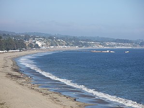
 Aptos with Seacliff State Beach and SS Palo Alto |
||
| Location in California | ||
|
|
||
| Basic data | ||
| State : | United States | |
| State : | California | |
| County : | Santa Cruz County | |
| Coordinates : | 36 ° 59 ′ N , 121 ° 54 ′ W | |
| Time zone : | Pacific ( UTC − 8 / −7 ) | |
| Residents : | 6,220 (as of 2010) | |
| Population density : | 377 inhabitants per km 2 | |
| Area : | 16.5 km 2 (about 6 mi 2 ) of which 16.5 km 2 (about 6 mi 2 ) is land |
|
| Height : | 33 m | |
| Postcodes : | 95001, 95003 | |
| Area code : | +1 831 | |
| FIPS : | 06-02378 | |
| GNIS ID : | 1657939 | |
Aptos is a census-designated place in Santa Cruz County in the US state of California . It is located in the north of Monterey Bay ( California coast ).
location
Aptos is ten kilometers east of Santa Cruz on Highway 1 . According to the 2010 census, the city has around 6220 inhabitants spread over 16.5 km² . It is located on the San Andreas Fault , near the epicenter of the Loma Prieta earthquake in 1989. Aptos is home to The Forest of Nisene Marks State Park and Seacliff State Beach Recreation Area .
CDP Aptos includes the settlements of Aptos Village, Seacliff, Rio del Mar, Seascape, La Selva Beach, Day Valley and Aptos Hills-Larkin Valley.
history
The name comes from the language of the Ohlone and means "meeting of two streams". Aptos Creek and Valencia Creek converge in Aptos.
In 1833 the government of Mexico gave an approximately 27 km² large area of land, the so-called Rancho Aptos, to Rafael Castro, who originally used it to raise cattle. After California became a US state in 1848, he leased his land to Americans who gradually built shops, a shipyard, a sawmill, and a tannery. From 1872 the sugar millionaire Claus Spreckels , who came from Germany, began to buy land from Castro. He had a beach hotel, a summer residence and a horse racing track built.
From 1880 to 1920, the timber industry boomed, mainly cutting redwood trees . Within 40 years, the tree population in what is now The Forest of Nisene Marks State Park was completely removed. After Spreckels' death, Seacliff Park and Rio Del Mar Country Club developed in the late 1920s, which now make up the Seacliff State Beach Conservation Area . A grand hotel as well as a polo and golf course were built. The tanker SS Palo Alto was anchored on the beach and converted into a pleasure ship with a dance hall and swimming pool. During the time of the Great Depression and the Second World War, development came to a standstill.
In the early 1960s a new phase of rapid urban expansion began. The Rancho Del Mar shopping center and Cabrillo College were built alongside many residential buildings .
Known residents
- Daniel Henry Holmes Ingalls, Jr. (born 1944), computer scientist
- Marisa Miller (* 1978), model
- Thomas Pynchon (* 1937), writer
Web links
- Aptos Community (English)
- Aptos Heimatmuseum (English)
Individual evidence
- ↑ Erwin Gudde; William Bright (2004). California Place Names (Fourth ed.). University of California Press. pp. 15. ISBN 0-520-24217-3 .
- ↑ Thomas Pynchon . In: The Heath Anthology of American Literature, Fifth Edition . Retrieved October 22, 2011.
