Aramaco
|
Aramaco Arapvaco |
||
|
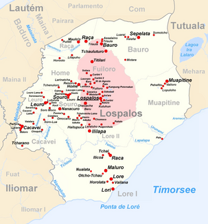
The Aramaco flows in the southeast of the administrative office of Lospalos |
||
| Data | ||
| location | Suco Muapitine , Lautém Municipality , East Timor | |
| River system | Aramaco | |
| muzzle | in the Timor Sea coordinates: 8 ° 33 ′ 27 " S , 127 ° 8 ′ 5" E 8 ° 33 ′ 27 " S , 127 ° 8 ′ 5" E
|
|
|
Tropical forest at the mouth of the Aramaco |
||
The Aramaco ( Ribeira Aramaco , Arapvaco , German way of the buffalo ) is a river in the East Timorese municipality of Lautém .
course
The Aramaco rises near the coast in Suco Muapitine ( administrative office Lospalos ) and flows into the Timor Sea on the border to neighboring Suco Mehara (administrative office Tutuala ) . 200 hectares of wetlands at the estuary form an ecologically valuable area that is part of the Nino Konis Santana National Park .
fauna
In 2006 the fish fauna of the river was examined. The river has round stones and muddy sediment. There is no vegetation hanging over the water. The following fish species have been identified:
- Anguilla marmorata
- Anguilla reinhardtii
- Awaous melanocephalus
- Bunaka gyrinoides
- Eleotris fusca
- Kuhlia marginata
- Liza melinoptera : This mullet species was first detected in 2006 in East Timor in the Aramaco. The fish migrate into rivers from the sea. In the Aramaco they were found in isolated basins, on the tidal line, two kilometers upriver from the coast.
- Lutjanus argentimaculatus
- Sicyopterus caeruleus
- Sicyopterus hageni
Web links
Individual evidence
- ↑ a b Helen K. Larson, Duncan Buckle, Jessica Lynas, Andrew Storey, Chris Humphrey: Additional records of freshwater fishes from Timor-Leste, with notes on the fish fauna of the unique closed Irasiquero River system
- ^ Community maps on the Timor-Leste GIS Portal ( Memento from June 30, 2007 in the Internet Archive )
- ↑ Colin R. Trainor: The waterbirds and coastal seabirds of Timor-Leste: new site records clarifying residence status, distribution and taxonomy , accessed April 19, 2014

