Poor man
| Poor man | |||
|---|---|---|---|
| Pass height | 574 m above sea level NHN | ||
| circle |
District of Siegen-Wittgenstein , North Rhine-Westphalia ( Germany ) |
||
| Valley locations | Bad Laasphe | Hesselbach | |
| expansion | Pass road | ||
| Mountains | Rothaar Mountains | ||
| profile | |||
| Ø pitch | 5.7% (239 m / 4.2 km) | 5.8% (127 m / 2.2 km) | |
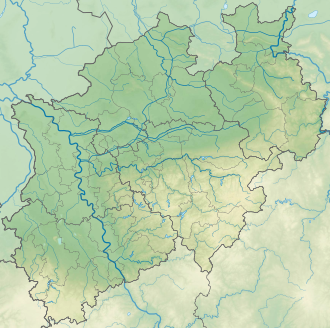
| Map (North Rhine-Westphalia) | |||
|
|
|||
| Coordinates | 50 ° 53 '32 " N , 8 ° 23' 11" E | ||
Poor man is the name of a 574 m above sea level. NHN high mountain pass in the Rothaargebirge in the area of Hesselbach in the North Rhine-Westphalian district of Siegen-Wittgenstein . The pass connects the towns of Hesselbach and Bad Laasphe . The mountain complex between the places is also called the poor man.
Pass road
The road connection is declared as district road 36 . As a junction of the federal road 62 ( 335 m ) with the name Gennernbach, it leads south through Bad Laasphe. The further ascent runs parallel to the Gennernbach valley. On the transition area between the Gerhartsberg ( 587.5 m ) in the east-northeast and the Spreitzkopf ( 627 m ) in the west-southwest, it reaches a height of 574 m about 90 m northwest of the Hessian border . As the road continues, it turns west. At 490 m above sea level, it reaches the entrance to Hesselbach and leads down through the village as the street Zum Spreit . In the center of the village it runs at an altitude of about 447 m .
In Hesselbach, the road proves to be the bottleneck for large motor vehicles whose drivers ignore the weight limit of 3.5 tons. Relocation plans for the road were not implemented due to the high cost of an estimated 900,000 euros.
A hikers' car park with a barbecue area near the pass is called Am Armen Mann .
By the hurricane Kyrill trees were knocked over on wooded hillsides over a large area. The storm caused great damage, especially at the apex of the county road. As a result, the road was closed for a long time.
Ore mining
At the end of the 17th century, ore was mined in the Gottessegen mine in the region . Copper deposits are documented around 1800 as well as ores containing lead and silver without dating.
Say about the origin of the name
It is said that the name Poor Man is based on a legend . One winter night a man from Hesselbach had a toothache. The only doctor was in Bad Laasphe, where he removed the tooth. On the way back to Hesselbach, he took bread with him. On the way back through the heavy snow, he suddenly sees a herd of five wolves . With a stick he can initially drive away the animals until he has no strength for it. With the bread he can keep the wolves at a distance. He beats the animals with his stick and the snow turns blood red. Fortunately, the forester's dog wakes up. The forester lets go of the dog and the man is saved. When he got home, he staggered through the door and stepped into the apartment full of fear and effort. With a deep sigh he mumbled the words: "Oh, poor man!"
Hesselbach wind farm
Among other things, the Hesselbach wind farm is located on the Spreitzkopf . The K 36 was converted into a one-way street for the respective construction work on the wind farm. The permitted direction of travel was from Bad Laasphe to Hesselbach. The reason for this was that any other traffic with the construction vehicles would be a safety risk.
Web links
Individual evidence
- ↑ Topographical Information Management, Cologne District Government, Department GEObasis NRW ( Notes )
- ↑ Bad Laasphe hiking route 1. (No longer available online.) Wanderkompass.de, archived from the original on October 21, 2016 ; accessed on October 21, 2016 . Info: The archive link was inserted automatically and has not yet been checked. Please check the original and archive link according to the instructions and then remove this notice.
- ↑ Bad Laasphe / Hesselbach: All six construction sites are already accessible via paths. berge-bau.de, April 26, 2013, accessed on October 21, 2016 .
- ↑ a b Wind farm is to be enlarged. (PDF) March 23, 2016, accessed October 21, 2016 .
- ↑ a b The poor man. opencaching.de, accessed on October 21, 2016 .
- ↑ Last turning point before Hesselbach. siegener-zeitung.de, May 28, 2015, accessed on October 21, 2016 .
- ↑ Hikers' parking spaces: mayor surprised by cross-off list. derWesten.de, February 19, 2016, accessed on October 21, 2016 .
- ↑ Where the tall spruce trees once stood out. wp.de, January 17, 2017, accessed on February 2, 2017 .
- ^ Pits in Wittgenstein. grube-gonderbach.de, accessed on October 21, 2016 .
- ↑ Bad Laasphe: Kreisstraße 36 temporarily one-way street. wp.de, April 7, 2017, accessed April 8, 2017 .


