Arthur Glacier (Antarctica)
| Arthur Glacier | ||
|---|---|---|
| location | Marie Byrd Land , West Antarctica | |
| Mountains | Ford Ranges | |
| Type | Valley glacier | |
| length | 40 km | |
| Coordinates | 77 ° 3 ′ S , 145 ° 15 ′ W | |
|
|
||
| drainage | Sulzberger Ice Shelf | |
|
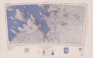
Map sheet Boyd Glacier from 1969, Arthur Glacier in the middle of the northern edge of the map |
||
The Arthur Glacier is a valley glacier around 40 kilometers long in Marie Byrd Land in western Antarctica . In the Ford Ranges it flows in a westerly direction between the Swanson Mountains in the north and the mountains Mount Rea and Mount Cooper in the south to the Sulzberger Ice Shelf .
It was discovered by participants on the western base of the United States Antarctic Service Expedition (1939–1941) during flights and on-site surveys between November and December 1940. The Advisory Committee on Antarctic Names named it after Rear Admiral Arthur C. Davis (1893–1965), Commander in Chief of the United States Navy flight units .
Web links
- Arthur Glacier in the Geographic Names Information System of the United States Geological Survey (English)
- Arthur Glacier on geographic.org (English)

