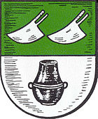
Ashausen
Ashausen is a district with 3800 inhabitants in the unified community of Stelle in the district of Harburg , Lower Saxony .
Ashausen has two kindergartens and a primary school. There are several craft businesses and agricultural operations in the village, which largely shape the townscape. The social life is strongly influenced by the local associations.
In Ashausen, one of the largest flea markets in northern Germany (largest in Tostedt ) takes place in the streets of the village every year at the beginning of June . The sports club MTV Ashausen celebrated its 100th anniversary in 2008. The following sports are offered: handball, football, judo, volleyball, table tennis, gymnastics, dancing, triathlon (with its own club), tennis (also a separate club). Every year in summer, beach handball tournaments take place on the company's own beach court. The Oberliga women have already secured the title of the Lower Saxony championship in beach handball several times.
The extensive cultural life for a village of this size, both in connection with the St. Andrew's Church and through private associations (e.g. choirs, orchestras, theater groups), should be emphasized.
Ashausen is connected to the rail network and local public transport through a Deutsche Bahn station on the Hanover – Hamburg line, and the metropolitan region of Hamburg with the metronom regional . Ashausen is best known for the Auenwald drink.
history
To a settlement of the area around Ashausen suggest mounds from the Late Stone Age and older Bronze Age (about 2500-1300 v. Chr.) Towards the south are the village. Shaft furnaces found during the construction of the motorway date from the pre-Roman Iron Age . On the Osterberg there was a burial ground from the 8th or 9th century, in which jewelry such as a neck ring, an arm ring and an arm spiral made of silver and weapons such as two spathae , lances and saxe were found.
Ashausen was first mentioned in writing in 1294 as Asselveshusen . According to the name researcher Jürgen Udolph , the place name is derived from the Germanic and Old Low German first names Aslev and Anslev.
At Ashäuser Mühlenbach, a tributary of the Seeve , there is a former water mill below the mill pond, which was first mentioned in a purchase agreement in 1321. In 1887 the mill burned down and was rebuilt shortly afterwards. A sawmill was also installed. It was not until 1950 that the water wheel was replaced by a turbine.
On May 1, 1847, the Celle – Harburg section of the Hanover – Hamburg line was opened to traffic.
From 1928 to 1976 the village was the north degradation instead of about 25 million cubic meters of gravel.
The Protestant St. Andrew's Church was built in 1963 and 1964. Before that the place belonged to the St. Gertrud Church in Pattensen .
On July 1, 1972, Ashausen was incorporated into the community of Stelle.
In 1987, the Winsen-West junction of the federal motorway 250 (later A 39 ) was opened, via which Ashausen is also connected.
In 1994 Ashausen celebrated its 700th anniversary.
Individual evidence
- ↑ Barrow field. Heimatverein Ashausen, accessed on January 5, 2018 .
- ^ Motorway construction. Heimatverein Ashausen, January 5, 2018, accessed on July 13, 2019 .
- ↑ Grave field on the Osterberg. Heimatverein Ashausen, January 5, 2018, accessed on July 13, 2019 .
- ↑ Historical overview of the community of Stelle. Municipality position, accessed on July 13, 2019 .
- ↑ Thomas Lipinski: What does Ashausen mean? In: Kreiszeitung Wochenblatt. August 27, 2013, accessed July 13, 2019 .
- ↑ Ashausen watermill. In: Lower Saxony Mühlenstrasse. Retrieved July 13, 2019 .
- ↑ Ashausen gravel extraction. Heimatverein Ashausen, January 5, 2018, accessed on July 14, 2019 .
- ↑ Our church: From St. Gertrud in Pattensen to St. Andreas in Ashausen. St. Andreas parish of Ashausen, accessed on July 14, 2019 .
- ^ Federal Statistical Office (ed.): Historical municipality directory for the Federal Republic of Germany. Name, border and key number changes in municipalities, counties and administrative districts from May 27, 1970 to December 31, 1982 . W. Kohlhammer, Stuttgart / Mainz 1983, ISBN 3-17-003263-1 , p. 228 .
- ^ Motorway construction. Heimatverein Ashausen, January 5, 2018, accessed on July 14, 2019 .
Web links
Coordinates: 53 ° 22 ′ N , 10 ° 8 ′ E

